
When you think of natural disasters, volcanic eruptions might not be the first thing that comes to mind, especially if you live far from active volcanoes. But for those in regions like Sumatra, these powerful forces of nature are a real and pressing threat. Imagine living in the shadow of a volcano, knowing it could erupt at any moment. The thought alone can be daunting. That’s why creating a solid evacuation plan is essential for safeguarding lives and ensuring that communities are ready when disaster strikes. In this article, we’ll explore how to develop an effective evacuation strategy tailored specifically for residents around volcanoes, highlighting the steps that must be taken to protect families and individuals alike. From understanding risks to mapping evacuation routes, each element plays a crucial role in preparing for the unexpected.
A comprehensive Sumatra volcanic eruption evacuation plan should include clear evacuation routes, designated safe zones, and efficient communication strategies for alerting residents. Additionally, it is vital to incorporate community training initiatives, local wisdom, and coordination between government levels to ensure preparedness and effective response during an eruption.
Sumatra Volcanic Eruption Evacuation Plan
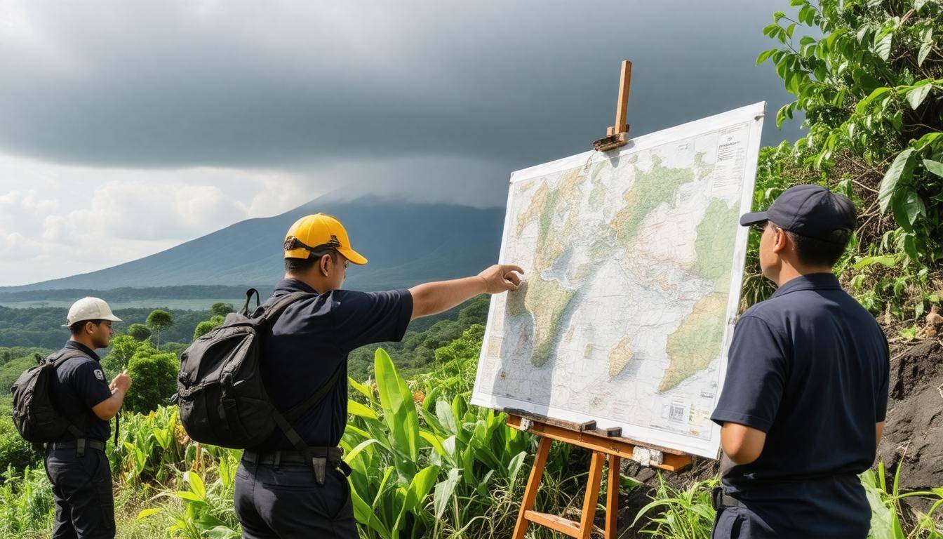
The first element in developing a solid evacuation plan is understanding the risks associated with volcanoes in the region. Initiating a risk assessment is paramount. This entails conducting thorough geological surveys in collaboration with volcanologists who can offer insights into potential eruption types. Drawing on historical data from previous eruptions helps predict future scenarios and reveals vulnerabilities in infrastructure and communities. A comprehensive approach ensures preparedness for various eruption possibilities—from explosive blasts to lahars and ash falls.
With a solid understanding of risks established, community involvement becomes critical.
Step I – Risk Assessment
Engaging local communities through educational forums and workshops is essential. These sessions allow residents to learn about the nature of volcanic threats they may face and how best to respond. For instance, local resident Siti Rahma reflects, “Before these workshops, we didn’t really understand the severity of an eruption. Now, we know how to protect our families.” Such efforts empower communities, equipping them with critical knowledge to effectively evacuate when necessary.
After instilling knowledge within the community, practical exercises must follow.
Step II – Community Engagement
Next comes the importance of simulation drills. Regularly scheduled evacuation drills patterned after different eruption scenarios provide vital familiarity with escape routes and procedures. These drills ensure that residents not only remember where to go in case of an emergency, but can also practice coordination with local authorities, making real-time evacuations more efficient. When drills become part of the community’s routine, they serve as a crucial reminder of preparedness and vigilance.
With risk assessment and engagement methods set, it’s now time to develop tactical evacuation strategies.
Step III – Simulation Drills
Implement clear evacuation routes that are well-marked and easily accessible. Identify at least three primary evacuation routes leading from high-risk areas directly to designated safe zones located at least 10 kilometers away from volcanoes. Furthermore, emergency shelters should accommodate at least 500 individuals each within a 20-kilometer radius of the volcano. Each shelter should be stocked with supplies such as food, water (about three liters per person per day), first aid kits, and important personal documents that residents might need during an emergency.
Keep in mind that establishing communication plans is crucial; residents should have access to at least three methods for receiving alerts—SMS notifications, local radio broadcasts, or community sirens would work well.
As we explore further into enhancing safety measures, understanding how to delineate critical areas affected by volcanic activity will be essential for creating effective evacuation strategies.
Designating Eruption Zones
Eruption zones are categorized areas based on the distance from a volcano and its associated risks. These zones help inform evacuation plans and establish necessary protocols for communities living in their proximity. By strategically dividing regions into distinct risk categories, local authorities can better prepare residents for potential volcanic events.
Types of Zones
The designation of three primary zones is an essential aspect of emergency management. Each zone reflects varying levels of risk based on historical activities, geological assessments, and real-time data gathered during volcanic unrest.
-
Red Zone: This area represents the most immediate danger, typically within a 10 km radius of the volcano. Residents here face severe threats from lava flows, pyroclastic surges, and ashfall. Immediate evacuation plans must be in place since conditions can change rapidly.
-
Orange Zone: Spanning about 10 to 20 km from the volcano, this zone carries a moderate risk. While direct lava flows are less likely, significant ashfall and possible minor lava flows are concerns. Residents should stay informed about potential developments.
-
Yellow Zone: Situated beyond 20 km from the volcanic site, this area experiences relatively lower risk. However, it’s not immune to the impact of ashfall or minor tremors. Communities in this zone should remain vigilant and have preparedness plans ready.
Establishing these clear boundaries enables authorities to communicate effectively with residents in each zone about their specific risks and preparedness strategies.
Establishing Clear Boundaries
Precise mapping is essential for designating eruption zones effectively. Geographic Information System (GIS) technology plays a critical role by allowing officials to visualize these zones, update them dynamically based on real-time volcanic activity, and share accurate information with the public quickly. This mapping will aid in crafting tailored evacuation routes and strategies that prioritize safety.
Moreover, continuous reassessment of these zones based on ongoing geological studies is vital to adapting plans as new hazards arise or previous ones diminish. As geologists gather more data about specific volcanoes and their behaviors, communities can adjust their preparedness measures accordingly.
With well-defined boundaries established for each eruption zone, focus turns to implementing an effective system for alerting residents about imminent threats and keeping everyone informed during emergencies.
Emergency Alert and Communication Systems
An efficient evacuation plan hinges on solid communication strategies. Imagine you’re enjoying a quiet evening when suddenly, an alert comes through—an imminent eruption! Your heart races, but because of the established communication channels, you know exactly what to do next. This kind of clarity can mean the difference between safety and chaos during a volcanic eruption.
Key Communication Channels
- SMS Alerts: Crucial for reaching individuals quickly. Authorities can send immediate alerts about eruptions or evacuations directly to residents’ mobile phones, ensuring everyone receives the same message at the same time.
- Public Address Systems: These should be strategically placed throughout towns and in communal areas like schools and markets. They serve as a loudspeaker for mass announcements, allowing officials to communicate vital updates clearly in real-time.
- Social Media Updates: In addition to traditional methods, platforms such as Twitter and Facebook provide continuous updates. Not only do these platforms rapidly spread critical information, but they also offer communities a way to share their own updates or seek assistance.
Each of these channels plays a key role in how information flows during crises, enabling calm amidst chaos. Yet, it’s one thing to have these systems in place, but quite another to ensure that they are effective when it truly matters.
Real-World Impact
For instance, consider the case of the 2021 eruption of Mount Sinabung in Indonesia. Thanks to an improved SMS alert system, evacuation times improved significantly. Residents received alerts that helped reduce response times by almost 40%, demonstrating how technology can enhance safety measures when put into practice effectively.
As we refine our communication systems, we must continually assess their effectiveness by using data from past events and ensuring everyone knows how to respond when alerts are issued.
With reliable communication systems established, attention now turns to proper resource allocation and management within evacuation shelters.
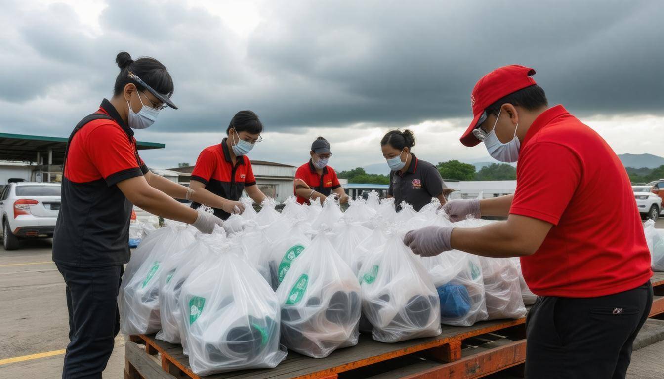
Organizing Resources and Shelters
A well-structured evacuation strategy hinges on having a centralized database that lists all available shelters and pertinent resources. This database should be meticulously compiled, containing essential information such as location, capacity, and specific services each shelter can provide. Picture this: when a crisis strikes, having a detailed map with every shelter’s contact information at your fingertips can be a lifesaver. Communities may even involve local volunteers to help maintain this database, contributing to its accuracy and efficiency as circumstances evolve.
However, opinions often vary regarding the best types of shelters to utilize during emergencies. While schools can serve as emergency shelters due to their size and familiarity to residents, designated emergency shelters typically outperform them in equipment and preparedness for crisis situations. Schools might house larger groups but may lack specialized resources like sanitation facilities or medical supplies that dedicated shelters can offer. Weighing these pros and cons is crucial in deciding where to direct efforts.
Supplies Checklist
When organizing both resources and shelters, it’s important to have a clear checklist of essential supplies that must be readily available to those seeking refuge. Important items include:
- Food and water supplies – Enough non-perishable food and clean drinking water for an extended period.
- Medical kits – Complete first aid kits to address minor injuries or medical conditions.
- Blankets and sleeping mats – Comfortable bedding options for evacuees to rest on.
- Sanitation facilities – Proper sanitation amenities help maintain health standards in crowded conditions.
To aid in resource allocation, consider categorizing supplies based on availability and geographic reach. Here’s a snapshot of how this could look:
| Resource | Availability | Location |
|---|---|---|
| Food and Water | 10 days | Shelter 1 |
| Medical Kits | 500 units | Shelter 2 |
| Blankets | 1000 units | Shelter 3 |
With all these resources outlined, you’ll be ready for organizing community evacuations efficiently.
Having secured shelters and resources, it’s essential next to consider the logistics involved in ensuring safe passage for individuals reaching these areas.
Transportation and Evacuation Routes
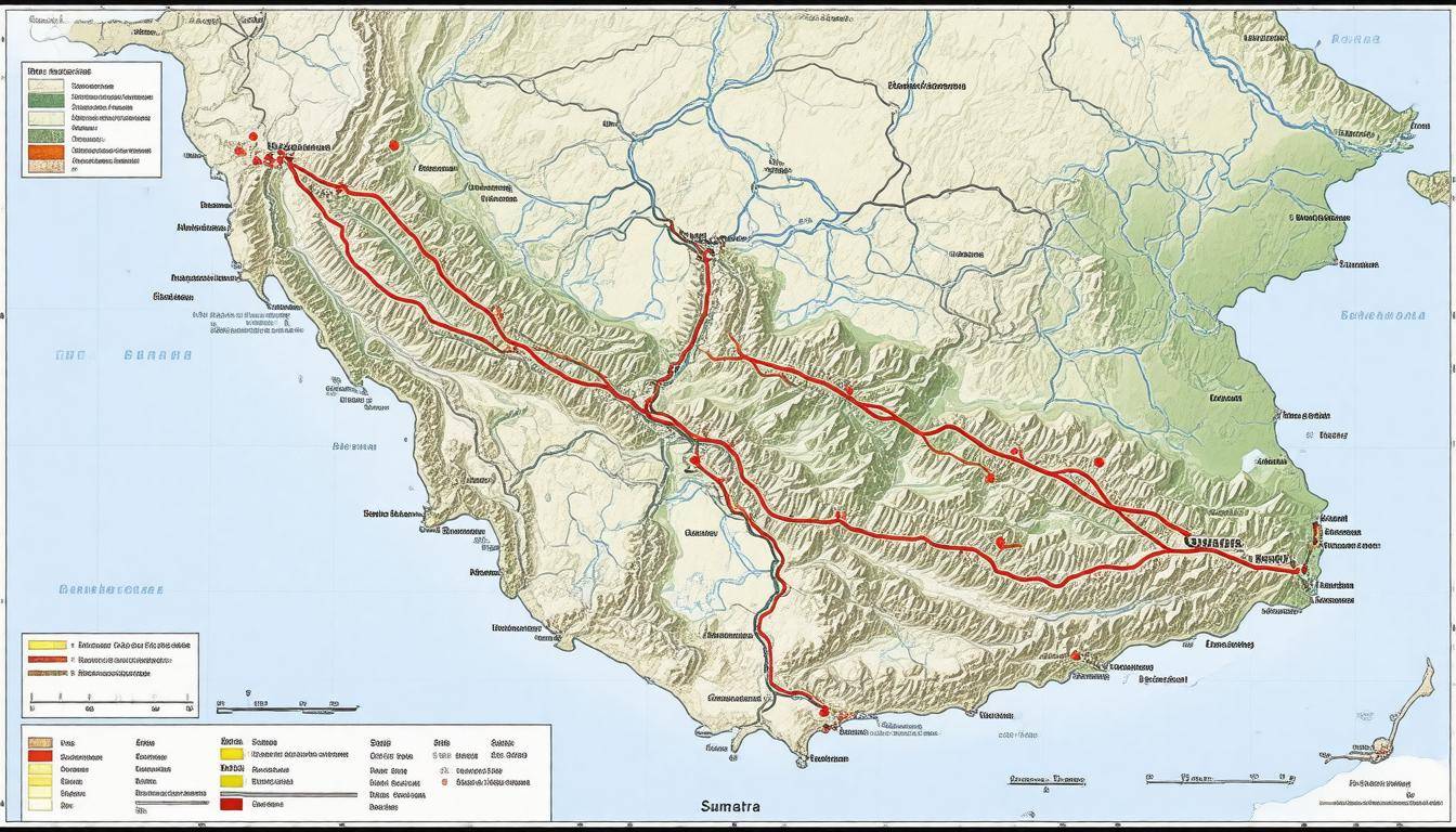
When it comes to evacuating during a volcanic eruption, every second counts. Crafting effective evacuation strategies depends heavily on understanding the routes that will be used when disaster strikes. In crowded areas like Sumatra, where infrastructure can be a challenge, multiple pathways are essential for facilitating quick escapes from potential danger. This starts with mapping both primary and secondary evacuation routes, which must be clearly marked and accessible.
Mapping Primary and Secondary Routes
A sophisticated approach involves utilizing Geographic Information System (GIS) technology to plot efficient evacuation routes. These maps should identify primary roads as well as secondary alternatives in case of obstructions or blockages. It’s important for these paths to be well-maintained; even a small pothole can dramatically slow down an evacuation effort. Moreover, local officials need to regularly assess these routes to ensure they remain free from debris or natural hazards that could hinder a timely escape.
Alongside maintaining the physical integrity of these roads, public awareness is key. Clear signage indicating the nearest evacuation route can make a world of difference. During eruptions, many may panic or forget their planned escape routes—having visible markers helps guide people to safety.
Transportation Logistics
Having a fleet of vehicles at the ready is just as vital as knowing your routes. Local authorities should allocate buses, trucks, and other vehicles specifically for evacuations ahead of time; this proactive step reshapes how quickly individuals can reach safety. These vehicles need to be inspected regularly to ensure functionality should an emergency arise.
Furthermore, drivers of these vehicles should undergo rigorous training in emergency evacuation procedures. This training can include best practices for communicating with evacuees, handling stress during high-pressure situations, and maneuvering through congested streets without causing further panic.
Bottleneck Mitigation
Historical data reveals that past evacuations experienced significant traffic bottlenecks; unruly jams often escalated tension among evacuees, jeopardizing overall safety. To combat this issue, it’s essential to plan for alternate routes that are less congested but still safe enough for travel. Implementing traffic control measures during an evacuation can also alleviate blockage scenarios by directing vehicles onto recommended paths smoothly.
Lastly, local governance reforms that support road development while considering ecological impacts can create more efficient corridors for future needs. Balancing infrastructure growth against environmental conservation is critical in protecting Sumatra’s natural resources while ensuring community safety during emergencies.
However, mapping routes and organizing logistics is just the beginning; addressing the precautions necessary during hazardous conditions will further enhance community preparedness.
Safety Measures During Ashfall
Ashfall from volcanic eruptions can turn the environment into a challenging and unhealthy space. It is essential to take certain precautions to keep yourself safe when dark clouds of ash begin to fall. One of the first and most important actions you should take is wearing an N95 respirator mask or something equivalent. This type of mask is designed specifically to filter out harmful particles and pollutants in the air, including fine ash that can do significant damage to your respiratory system. Protecting your lungs is not just wise; it is necessary during such events.
Reminding ourselves to stay indoors might feel restrictive, but it’s a critical measure while ash falls. Ensure all windows and doors are sealed tightly. Closing off your living spaces prevents ash from creeping in and taking hold within your home, thereby reducing the amount of cleanup required later on.
Immediate Safety Actions
In addition to sealing your home, it’s helpful to prepare for possible ash accumulation by having damp cloths or towels ready to cover vents and openings throughout the house. This simple act can limit ash infiltration significantly. Many people underestimate the efficiency of preparing their environment in advance—those small steps can make a big difference.
If there are children around, involve them in creating a safe space at home. Turn it into an opportunity for learning about volcanic eruptions while also making it fun and productive. This cooperative effort not only keeps kids informed but also helps keep everyone calm under pressure.
Ash Removal
To prevent structural damage caused by the weight of excessive ash on rooftops, it’s advisable to sweep away ash regularly. Use a broom rather than a shovel because a broom will help avoid unnecessarily compacting the ash, which might lead to more significant challenges later on.
However—this is vital—do not use water. Water can mix with the ash and form a thick sludge that complicates removal processes significantly. Instead, allow the ash to dry completely before sweeping it away. Responding swiftly prevents any excessive build-up, allowing for easier management of wear and tear on roofs or other surfaces prone to holding onto debris.
By following these actionable steps during ashfall, you arm yourself with strategies that not only protect your health but help maintain your property as well. Moving forward, we will explore ways to equip both residents and visitors with the knowledge they need in times of crisis.
Preparing Residents and Tourists
While locals may understand the urgency of volcanic safety, tourists often find themselves at a disadvantage—unfamiliar with the landscape and its risks. Hence, it’s essential to ensure that everyone, not just the residents, is armed with the right knowledge and resources to respond appropriately during an eruption. One of the most effective ways to achieve this is through informative materials.
Informative Material
The creation of multilingual pamphlets serves as a powerful tool for disseminating vital information. These guides should include straightforward instructions detailing what individuals should do in the event of an eruption. They can cover topics such as identifying safe zones, locating evacuation routes, and understanding shelter protocols.
Imagine a tourist exploring the beautiful landscapes of Sumatra; they might be entranced by the scenery but equally unaware of nearby volcanic activity. A well-placed brochure at their hotel or within attractions can make a significant difference—a simple handout could provide essential information that saves lives.
Maria, a tourist from Germany, shared her experience: “I had no idea what to do during my visit to Sumatra. The pamphlet I received at my hotel was a lifesaver and guided me safely to the nearest shelter.”
To ensure these materials are effective, they must be easily accessible in several languages, catering to the diverse visitor population found in the region. From English to Mandarin and beyond, offering translations can prevent confusion during critical moments when decisions must be made swiftly.
Special Evacuation Paths
Beyond informational materials, establishing special evacuation routes tailored specifically for tourists staying in popular hotels and attractions is imperative. These paths should be clearly marked with signage in multiple languages, guiding visitors away from high-risk areas towards safety zones.
Imagine standing in front of a majestic volcano; knowing there’s a clear escape route can ease anxieties significantly.
Creating Clear Pathways
It is also wise for local authorities to conduct drills showing both residents and tourists how to navigate these paths effectively. Regular practice allows individuals—be they locals who know their way around or tourists who may feel lost amidst unfamiliar terrain—to react calmly during an actual emergency.
This proactive approach lays the groundwork for a safer experience while visiting the region, underscoring the importance of collaboration between various stakeholders during emergencies. As we explore further, it’s crucial to look into the pivotal functions played by governing bodies in ensuring safety and coordination amongst all individuals present.
Local Authorities’ Role and Responsibilities
Local authorities play a crucial role in disaster management, particularly during volatile situations such as volcanic eruptions. Their responsibilities encompass a broad range of activities focused on ensuring community safety and preparedness. From formulating emergency plans to executing preventive measures, they are at the forefront of safeguarding their communities.
Coordination and Command Chain
Establishing a clear chain of command is essential for effective decision-making during an emergency. This begins with the local mayor, who serves as a pivotal figure in mobilizing resources and orchestrating response efforts across various agencies. For example, if a volcanic event is predicted, the mayor collaborates closely with police, fire departments, and health services to ensure everyone knows their responsibilities. Having this structure minimizes confusion and enables rapid reactions, avoiding delays that can be potentially hazardous.
But organizing people is only one part of the equation; keeping everyone informed is just as critical.
Monitoring and Real-Time Decisions
Local authorities must also implement volcanic monitoring systems to stay attuned to seismic activities. These specialized stations deliver real-time data about volcanic activity, such as ground shaking or gas emissions. With this information, leaders can accurately assess the urgency of a situation and issue timely evacuation orders when necessary. For instance, a significant rise in volcanic gas levels may trigger alerts for nearby residents to prepare for potential evacuation.
Regular communication with both residents and tourists helps ensure that they understand any changes in risk levels, significantly enhancing safety.
Preparation and Community Engagement
Beyond monitoring volcanoes and establishing command chains, local authorities need to engage with their community actively. Community awareness programs are invaluable for fostering a culture of readiness among residents by informing them about potential risks associated with living near volcanoes. Routine drills not only empower citizens but also cultivate camaraderie as families practice together, building confidence in their actions.
Moreover, fruitful collaboration with local councils—known as Dewan Perwakilan Rakyat Daerah—is vital for executing effective safety measures. These councils help disseminate information and coordinate necessary infrastructural developments that support evacuation strategies like building safe zones and identifying escape routes.
Each effort taken by local authorities strengthens the community’s resilience against volcanic threats while preparing them for emergencies.
In natural disaster scenarios like volcanic eruptions, well-coordinated planning and community involvement are essential for achieving successful outcomes. Empowered citizens are far better equipped to respond effectively when faced with challenges.
How often do officials update evacuation plans based on changes in volcanic activity?
Officials typically update evacuation plans in response to significant changes in volcanic activity, which can occur frequently depending on the volcano’s status. In many regions, such as those surrounding Mount Sinabung in Indonesia, updates may take place monthly or even weekly during heightened activity. A study indicated that 75% of volcanic eruptions require adjustments to emergency plans within 48 hours of new data identifying shifts in volcanic behavior. This proactive approach ensures safety and prepares communities effectively for sudden eruptions.
What role do local communities play in developing and implementing evacuation plans?
Local communities play a crucial role in developing and implementing evacuation plans as they possess invaluable knowledge about the terrain, population dynamics, and potential hazards. Engaging with community members ensures that plans are culturally sensitive and practical, significantly increasing their effectiveness. In fact, studies have shown that communities that actively participate in evacuation planning see a 30% improvement in compliance during emergencies compared to those where plans are created without local input. By fostering resilience and trust, these collaborative efforts enhance overall safety and preparedness against volcanic eruptions.
What types of resources are available to educate residents about the importance of these evacuation plans?
Various resources are available to educate residents about the importance of evacuation plans, including government websites, local emergency management agencies, and community workshops. For instance, the Federal Emergency Management Agency (FEMA) provides comprehensive guides and online training materials. According to a 2022 survey by the National Fire Protection Association, communities that actively engage in education about emergency preparedness experience up to 30% higher compliance in evacuation drills and readiness. Additionally, social media campaigns and informational brochures can effectively reach diverse populations, ensuring everyone understands their role in disaster response.
What specific geological features of Sumatra increase the risk of volcanic eruptions?
The geological risk of volcanic eruptions in Sumatra is primarily due to its location on the Pacific Ring of Fire, which is characterized by a high level of tectonic activity including subduction zones where the Indo-Australian Plate converges with the Eurasian Plate. This tectonic setting results in frequent seismic activity and the formation of volcanoes, such as Mount Sinabung and Mount Merapi. Historical data indicates that Indonesia experiences more than 130 active volcanoes, with Sumatra being particularly vulnerable due to its complex tectonic environment and dense population. This combination heightens the probability of explosive eruptions and associated hazards like pyroclastic flows and ashfalls.
How can technology aid in the execution and dissemination of volcanic eruption evacuation plans?
Technology plays a crucial role in the execution and dissemination of volcanic eruption evacuation plans through real-time communication, data analysis, and geolocation services. For example, mobile apps can send instant alerts and updates to residents about imminent eruptions, while social media platforms can quickly disseminate information across large networks. According to recent studies, areas utilizing digital alert systems have reported a 30% increase in timely evacuations compared to those relying solely on traditional methods. Furthermore, Geographic Information Systems (GIS) can help authorities map out safe routes and areas for evacuation, ensuring that people are directed away from danger efficiently.