
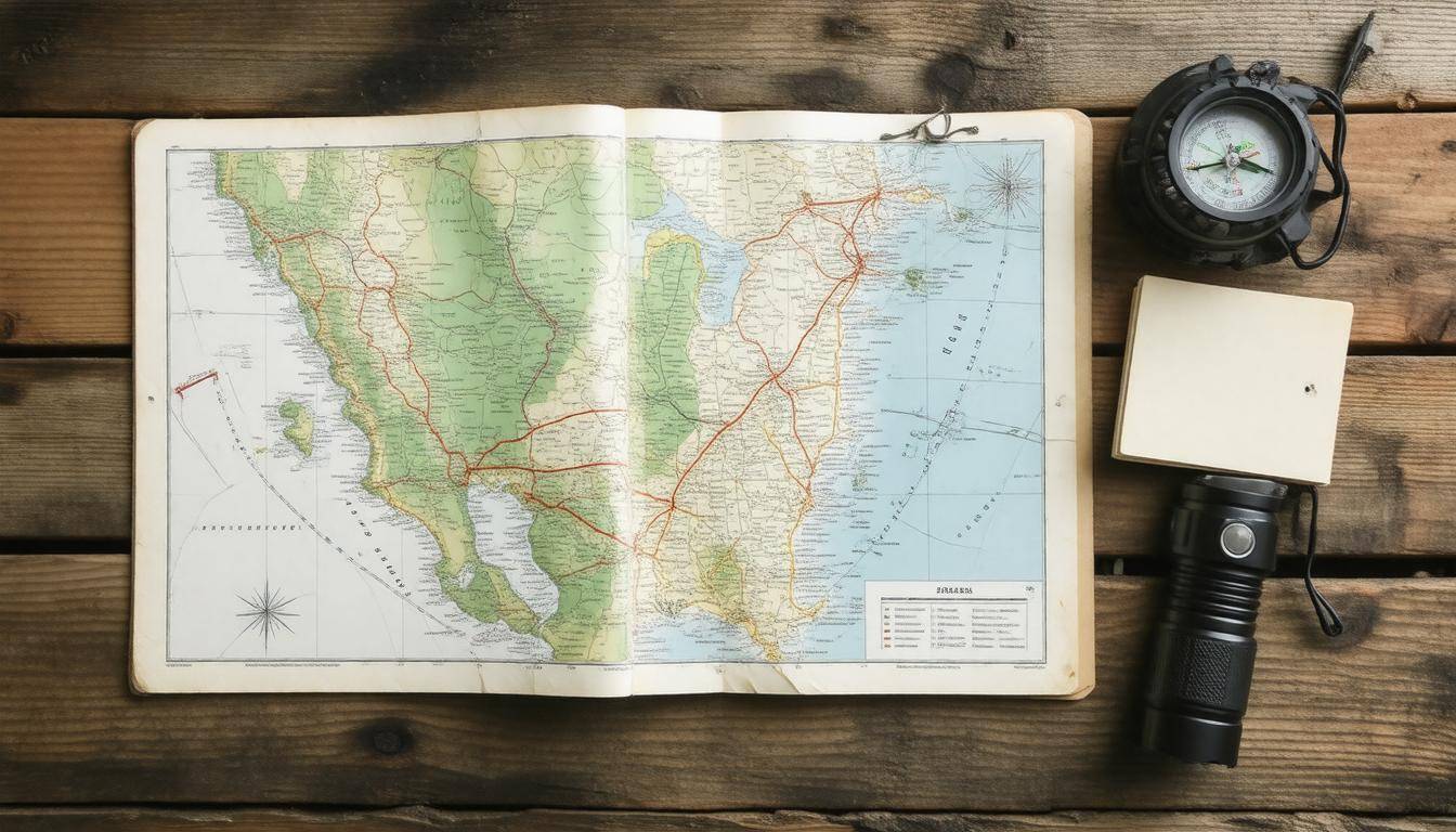
When planning for emergencies, the importance of having reliable paper maps can’t be overstated. While digital maps can be great, they often fail when we need them most—like during a power outage or when cell service drops. Think about it: how many times have you relied on your phone only to find out it died at the worst moment? Having a collection of physical maps ensures that you’re not left scrambling for directions when every second counts. Not only do these maps guide you through familiar and unfamiliar territories alike, but they also provide peace of mind that you’re prepared for whatever comes your way. Let’s explore those essential resources that can help enhance your safety planning.
Reliable sources for obtaining paper maps for emergency planning include the US Geological Survey (USGS), which provides free access to a variety of geological and topographical maps, and National Geographic, known for offering detailed terrain and topographic maps. Additionally, incorporating these physical maps into your emergency supply kit can enhance navigational reliability during evacuations or natural disasters.
Essential Paper Maps for Emergency Planning
One of the primary tools at your disposal during emergencies is a collection of essential paper maps tailored to your locality. A detailed road map provides an overview of both primary and secondary routes, giving you multiple alternatives for evacuating crowded or hazardous areas. These maps should include not only major highways but also back roads that might be less traveled, allowing for quicker escapes when main routes become congested. If you’ve ever tried to navigate during an evacuation, you know that familiar roads can quickly become problematic. Therefore, it’s wise to plan ahead and familiarize yourself with less obvious paths.
In addition to road maps, you’ll want to consider other types of essential maps:
-
Topographic Maps: These provide insight into the terrain, highlighting significant changes in elevation, which can be vital for assessing travel feasibility in certain natural disasters such as floods or mudslides.
-
Evacuation Maps: Created by local government agencies, these pinpoint designated evacuation routes and safe zones — crucial assets when managing a quick exit from an emergency situation.
-
Flood Zone Maps: Essential in flood-prone areas, these delineate regions at risk for flooding, enabling property owners and travelers alike to avoid hazardous zones.
-
Wildfire Risk Maps: For those living in fire-prone regions, these maps identify areas likely to experience wildfires, allowing residents time to assess their evacuation plans.
-
Hazardous Materials Maps: Useful in urban settings, these indicate locations of hazardous materials which can pose additional risks during emergencies.
Each type of map serves a distinct purpose; addressing all potential threats ensures comprehensive preparation.
An often-overlooked resource lies within public transportation maps. While they may seem less critical during extreme events or evacuations, understanding public transit systems can provide alternate routes or opportunities for escape when personal vehicles may be unavailable. Knowing the closest bus lines or train stations could literally change the game when time is of the essence.
With the increasing reliance on dual-method navigation—both digital and paper—due to emerging vulnerabilities in technology, having these physical resources becomes even more pressing. Since paper maps aren’t subject to battery failures or signal loss, they remain reliable tools ensuring you have access to crucial information regardless of circumstances.
Always keep your essential paper maps stored in an easily accessible location and incorporate them into your emergency go-bag alongside items like food, water, and a first aid kit. The peace of mind gained from thorough preparation cannot be overstated; it’s about ensuring safety for yourself and your loved ones when every moment counts.
As we move forward, exploring how to acquire these vital resources effectively will significantly enhance your readiness for emergencies.
Topographic and Road Maps
Topographic maps are designed to reveal the intricate details of the land’s surface. They display every contour, ridge, and valley, conveying elevations through contour lines. Understanding the shape and elevation of the terrain is essential during emergencies; knowing what areas lie higher or lower can be pivotal for hazard assessment.
For instance, if you’re in a region prone to floods, these maps show you safe escape routes to higher ground that might not be visible on standard road maps. This ability to visualize the land can mean the difference between safety and risk during natural disasters.
National Geographic provides exceptional topographic maps that can help pinpoint these critical high-ground areas, particularly in flood-prone regions.
Road Maps
On the other hand, road maps focus primarily on transportation routes, detailing everything from highways to smaller streets. During an emergency, especially when evacuation becomes necessary, knowing where main roads lie in relation to your current location is crucial. These maps outline the safest paths to take during unpredictable situations such as fires or floods when road conditions may quickly change.
You might find that some routes could be blocked or transformed due to debris or flooding; thus, having a reliable map can allow you to identify alternative paths quickly.
**
National Geographic features detailed road maps within their offerings, while Rand McNally is renowned for producing comprehensive information that ensures you always stay on course.
Yet while these broader categories offer essential information, it’s critical not to overlook how local and regional maps also play significant roles in effective emergency planning.
Regional and Local Map Types
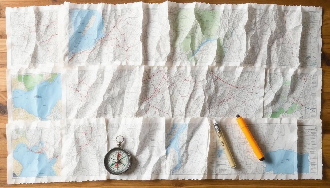
Exploring regional and local maps reveals a treasure trove of information that can significantly aid in emergency planning. These maps are not merely tools for navigation; they weave together vital details about the land and infrastructure, enabling individuals to make informed decisions when crises arise. From broader overviews to specific street-level data, each type of map has its unique role in enhancing situational awareness.
Regional Maps
Regional maps serve as essential tools for understanding larger geographic patterns and topographies. Often produced by state geological surveys or environmental agencies, these maps provide critical insights into terrain characteristics—such as hills, valleys, and bodies of water—that may impact evacuation or emergency responses. For example, knowing where rivers flood frequently or identifying areas prone to wildfires allows communities to prepare effectively and ensure safe travel routes.
“Regional maps are invaluable assets for strategic planning; they give you the big picture needed for successful emergency responses.”
This wider perspective is beneficial not only for individual preparedness but also for community planning, as it helps authorities designate evacuation routes and establish the locations of temporary shelters.
Local Maps
On the other hand, local maps zoom in on the intricacies of neighborhoods and urban layouts, offering a detailed view often overlooked in broader regional assessments. Produced by municipalities or county planning departments, these maps can illustrate everything from individual streets to the locations of fire stations and hospitals. In times of crisis, knowing the nearest emergency service can be life-saving.
Using local maps during an emergency can save precious time in unfamiliar areas. They provide intimate knowledge of your surroundings that could prove crucial when every second counts.
Moreover, these local tools help residents stay informed about utility lines and disaster recovery centers within their communities. For those interested in personal safety, having access to intricate details about neighborhood layouts is indispensable—especially when navigating potential hazards or evacuating quickly.
With numerous resources available for sourcing both types of maps, having easy access to this information becomes pivotal for effective emergency preparedness. As we move forward, let’s uncover the optimal resources available for accessing detailed mappings that further enhance our safety plans.
Best Sources for Detailed Maps

When it comes to emergency planning, having access to accurate and comprehensive maps can make all the difference. Topographic maps, in particular, are invaluable tools that provide critical information about terrain features and elevation changes that may impact evacuation routes or safe zones during emergencies. One of the foremost providers of such maps is the U.S. Geological Survey (USGS), which develops and maintains a variety of topographic map series suitable for different needs.
Government Agencies
Aside from the USGS, government agencies like FEMA and state geological surveys produce a wealth of maps that can be invaluable during crises. FEMA offers floodplain maps that help identify areas at risk for flooding, while state geological surveys provide regional data informing decisions regarding land use and natural disaster preparedness. These maps are often free and accessible online, straightforward to download or print when needed.
It’s wise to familiarize yourself with these sources because they not only provide updated data but also include resources that highlight demographic trends and population density around certain areas—information you’ll want when making safety plans for you and your family.
Commercial Publishers
On the commercial side, publishers like National Geographic and MapQuest offer high-quality outdoor maps durable enough to withstand various weather conditions. National Geographic’s maps are renowned for their detail and clarity, making them perfect for both outdoor adventures and emergency preparedness. Meanwhile, MapQuest, while more commonly known for digital directions, also offers printable versions of their maps that are user-friendly and easy to read.
These commercially produced maps can provide greater context than most government-issued ones. They typically come in waterproof formats which make them ideal additions to any emergency kit, especially considering how quickly weather can change during a crisis.
Always look for features such as scale ratios or contour lines on these maps; understanding these aspects can significantly enhance your ability to navigate through unfamiliar territories if an emergency arises.
Having gathered all this vital information regarding map sources, now we turn our focus to how these resources can be effectively included in your preparedness strategy.
Integrating Maps into Emergency Kits
Including paper maps in your emergency kits ensures they are readily available when needed. The best way to start is by considering storage solutions that prioritize both accessibility and durability. When folding maps for compact storage, maintain their readability; the last thing you want during a crisis is to struggle deciphering critical information due to poor folding. It’s wise to keep them in a waterproof, transparent sleeve to protect against weather damage. Think of it like putting on a raincoat before going out — it’s an extra layer of security that goes a long way.
As you prepare those maps, it’s also tremendously helpful to annotate vital information directly on them. Use a waterproof marker to indicate locations of emergency shelters, hospitals, or known hazardous zones. These personalized notes transform generic maps into customized survival tools tailored specifically to your needs. In the chaos following a disaster, knowing exactly where to go can save precious time and keep you and your loved ones safe.
Enhancing your preparedness goes beyond just having the right maps; it involves making sure they’re in sync with other essential items in your emergency kit.
While you’re at it, don’t forget to include lists of important phone numbers and websites for local emergency services alongside your maps. Storing these resources together creates a comprehensive toolkit that simplifies decision-making during emergencies. Remember the checklist! When packing your emergency kit, ensure all components work harmoniously together; consistency across documentation helps minimize confusion when every second counts.
Lastly, revisit your emergency kit periodically, ideally every six months. This is not just about rearranging items but ensuring that your maps and other supplies are current and effective. Regularly check if any evacuation routes or emergency contact details have changed since the last update. Keeping everything organized and up-to-date amplifies your readiness and gives you peace of mind as you wait for normalcy when emergencies strike.
With these preparations in place, it’s time to explore additional resources and tools that can further enhance your navigation capabilities in times of crisis.
Tools and Resources for Navigation
When it comes to effective navigation, having the right tools at your fingertips makes all the difference. One of the most fundamental tools you’ll need is a magnetic compass. This little device is invaluable when combined with your paper maps. By teaching yourself how to read a compass alongside your map, you can orient yourself in unfamiliar terrain with ease. It’s like having an old friend guiding you through a dense forest; together, they provide clarity amidst chaos.
In addition to your compass, consider including a protractor and a ruler in your kit. These tools will allow you to plot precise routes on your map, ensuring that you aren’t just wandering aimlessly. Being able to quantify distances accurately helps make your travel decisions more informed and efficient. Not only does this save time, but it also increases confidence when navigating through the wilderness or an unfamiliar city.
As you equip yourself with tools like these, don’t overlook the importance of visibility. Ready.gov highlights that having a flashlight with extra batteries in your emergency kit is crucial. There’s nothing worse than trying to decipher your map in dim lighting or during nighttime emergencies. With ample light, every detail on the map becomes visible, preventing costly mistakes.
However, just having these tools isn’t enough; knowing where to find them is equally vital. Most outdoor sporting goods stores carry these essential navigation tools. If time allows, consider checking local outdoor clubs or community centers that may offer workshops or courses on map reading and navigation skills. Such interactions not only broaden your understanding but also introduce you to a community committed to safety and preparedness.
Furthermore, remember to embrace technology alongside traditional paper maps. While navigating through urban areas, a GPS unit can complement your paper mapping efforts effectively. Invest in one that updates regularly to ensure accurate data. Typically, a dual method of navigation—using both digital and physical maps—will enhance your situational awareness significantly.
Effective navigation combines not just the right equipment but also knowledge of where to source it and how to use it efficiently.
This interconnectedness lays the groundwork for understanding the various methods available for obtaining maps—both free and paid options that can serve as valuable assets in emergency planning.
Acquiring Free and Paid Maps
When it comes to emergency planning, the value of having reliable maps cannot be overstated. Many credible sources offer free maps that serve as invaluable tools. For instance, the US Geological Survey (USGS) provides detailed topographic maps to help you navigate even the most challenging terrains. By visiting their website or office, you can access these maps, which illustrate elevations and natural features critical for outdoor expeditions or disaster evacuations.
Moreover, FEMA offers flood hazard maps at no cost, particularly useful if you live in regions prone to flooding. These maps make it easy to identify high-risk areas. Additionally, most state geological surveys publish regional maps highlighting local features essential during emergencies. Contacting these agencies directly or browsing their online platforms can uncover a treasure trove of free materials tailored to your region’s needs.
However, if you want higher quality or specialized details, turning to paid options may be beneficial.
For those seeking more comprehensive and durable maps, investing in paid resources is a wise choice. Companies like National Geographic pride themselves on producing premium products designed for rugged use and detailed insights into specific areas. These maps are often weather-resistant and constructed from sturdy materials that withstand wear and tear—especially helpful during outdoor events in variable weather conditions.
When deciding which paid map to purchase, consider what unique features you need. Are you looking for a specific topographic layout, emergency facilities locations, or perhaps evacuation routes? Some subscription services also provide specialty maps for outdoor activities. While it may be tempting to rely solely on digital maps and apps for their real-time updates, remember that technology-based options risk failure when batteries die or signals drop out during emergencies.
Balancing between free and paid resources ensures you have adequate documentation tailored to your emergency preparedness plan. Accessing both types of maps—from government sources and trusted commercial publishers—will enhance your readiness to navigate any situation life throws at you.
With this foundational knowledge of map resources, we can now move forward to explore how to craft a tailored emergency strategy that fits your unique needs.
Making a Personalized Map Plan
Crafting a personalized map plan is an empowering step in emergency preparedness that ensures you have clear protocols tailored for your unique situation. Think about how calm and assured you’d feel when disaster strikes if you have a structured plan right in front of you. With this map, you’ll know exactly where to head and what routes to take, reducing confusion in times of panic.
Steps to Create a Personalized Plan
Start by marking down key locations on your map. This should include your home, workplace, schools, hospitals, and emergency shelters—all critical destinations during an evacuation scenario. They serve as anchor points that can help guide your decisions when every second counts. When I first created my own map, I felt an immediate sense of relief knowing those vital spots were laid out visually.
Next, develop multiple evacuation routes to these locations. Don’t just rely on one pathway; map alternatives using different roads. This flexibility can be crucial during an emergency when certain routes may be blocked or unusable. Keep potential obstacles in mind—things like rivers, railway tracks, or construction zones can hinder safe passage. Consider color-coding the different routes; for example, use bright red for primary paths and orange for secondary ones to make them easy to spot.
Attention should also be paid to reviewing and updating the map regularly. Your neighborhood evolves; new roads might open up, some areas might become hazardous due to development projects, or new facilities such as clinics might pop up that deserve to be marked on your map. Consistently evaluate not only the physical attributes of your locality but also consider changes in laws or community support options that could affect how you should navigate these emergencies.
Having a personalized map plan isn’t just about being literate in navigating geographic spaces; it instills a sense of control over your safety amidst chaos.
Ultimately, personalized map plans significantly enhance readiness and should be designed with meticulous detail. Creating clear maps that accurately reflect the real-world environment contributes to peace of mind and ensures everyone involved understands the protocol. With everything outlined clearly, you can focus on executing the plan rather than constructing it under stress.
Incorporating these steps into your emergency planning will prepare you for any eventuality with confidence and clarity. Utilizing traditional maps alongside modern resources provides additional assurance during crises.