
As the seasons change, so do the road conditions, and unfortunately, many routes face temporary closures that can throw a wrench in your travel plans. Whether it’s heavy snowfall closing mountain passes or landslides blocking coastal highways, being caught off guard can lead to unnecessary stress and delays. That’s why it’s essential to know how to navigate these seasonal hurdles effectively. In this article, we’ll explore alternative routes, share handy navigation tips, and dive into ways to stay informed about road conditions—ensuring that your journey remains on track despite the unpredictable nature of seasonal closures.
When facing seasonal road closures, it’s essential to plan your trip by considering alternative routes such as taking major highways or detours that maintain accessibility. For example, if a popular mountain pass is closed, drivers might utilize the nearest interstate or state highway that bypasses the closure while still reaching their destination efficiently. Always check for updated conditions before traveling.

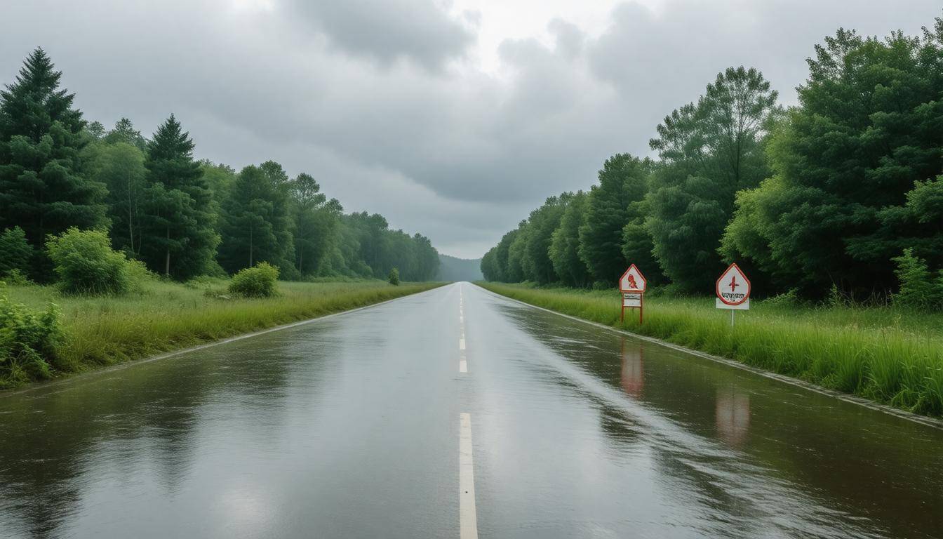
Seasonal Road Closures and Their Impact
Seasonal road closures can significantly reshape the travel landscape, particularly in regions like Utah and California known for their rugged terrains and unpredictable weather patterns. In Utah, for instance, closures such as SR-39 Monte Cristo and SR-92 American Fork Canyon typically take place from November through May, altering the routes available for daily commuters and tourists alike. This means that tens of thousands of travelers are effectively cut off from accessing scenic bays or vital work commutes during these cold months.
The ramifications of road closures extend beyond mere inconveniences. With approximately 1,200 seasonal road closures each year in the U.S.—lasting around 45 days on average—estimations suggest that a 30% increase in travel times is common when alternate routes must be taken. Furthermore, 60% of these closures are weather-related, highlighting the importance of staying informed.
For many local economies, particularly those reliant on tourism—like businesses near Highway 1 in Big Sur—the implications can be devastating. Frequent landslides have made sections impassable over recent winters, marking the area not just a scenic destination but one plagued by unpredictable access.
This unpredictability leads to challenges beyond just travel disruptions; it forces relevant businesses to rethink their strategies throughout these seasons. Imagine running a quaint café right off a popular highway that suddenly has no traffic flow because of closures—you’d certainly be concerned about making it through the winter. As road access slows down, so do sales.
Given all these obstacles, adopting effective contingency planning to navigate through significant travel hiccups becomes increasingly crucial.
Relying solely on technology or assumptions isn’t enough anymore; maintaining a connection with reliable local information sources like the UDOT Traffic website or apps that provide regular updates can deeply impact your itinerary planning. Prepare to pivot at a moment’s notice while factoring in how seasonal changes could cost you extra time and potentially complicate your plans further.
Understanding the broader impact of seasonal road closures allows travelers to safeguard their journeys better. From adjusting travel routes to seeking alternative modes of transportation—like biking—having backup options prepares one for an adventure filled with unexpected turns while minimizing frustrations.
As we consider these navigation strategies and embrace alternative routes, let’s explore the most reliable avenues for detour information that can simplify your travels even further.
Best Detour Information Sources
To effectively maneuver around seasonal road closures, having access to trustworthy resources is key. For example, the UDOT Traffic website and its accompanying app are not only user-friendly but also provide real-time updates specifically for road conditions in Utah. Meanwhile, Caltrans serves a similar purpose in California, offering timely notifications about various road conditions and closures. These official sources make it easier to stay informed and adjust your travel plans without missing a beat.
| Source | Features | Accessibility |
|---|---|---|
| UDOT | Real-time updates; Mountain Passes map layer | Website, App |
| Caltrans | Road-specific notifications; live traffic cameras | Website, App, Social Media |
| Waze | User-generated real-time traffic updates; optimal detour suggestions | App, Website |
Additionally, utilizing community-driven platforms like Reddit can provide localized insights from people who are currently navigating the roads. Here, users often share firsthand accounts of traffic conditions or alternative routes that may not yet be reflected by official sources. Local radio stations remain another reliable option—they provide real-time updates and can inform you of sudden changes due to accidents or weather conditions.
While these resources offer crucial information, it’s essential to appreciate how external factors can impact your travels even further. As you navigate challenges on your journey, understanding these influences will facilitate more informed decision-making as you plan your route.
Weather Effects on Road Access
Weather can be a traveler’s best friend or worst enemy. A bright sunny day can turn a simple trip into a delightful journey, while sudden rain or snowfall may transform that same route into an obstacle course. When traveling through mountainous areas such as those in Utah or California, it’s important to comprehend how severe weather patterns can disrupt road accessibility. For example, ice and snow can render roads like SR-150 Mirror Lake Highway completely impassable from November through May. The same goes for heavy rains, which often trigger landslides along coastal routes like Highway 1 in Big Sur.
Some regions experience astonishing weather statistics; according to NOAA, areas in the western U.S. receive up to 60 inches of snowfall annually. This significant accumulation raises serious concerns about road safety and access during winter months when many highways are forced to close temporarily. It’s crucial for travelers to pay attention to these forecasts—not just for their own safety, but also to prevent travel plans from becoming derailed unexpectedly.
While it may seem cumbersome, keeping a close eye on weather changes isn’t just a precaution; it’s a necessity for effective travel planning.
In this age of technology, relying on apps and reliable news outlets for real-time weather updates is more accessible than ever. Many travelers have found success using the Weather Channel app, which offers accurate forecasts and sends notifications about severe weather alerts directly to your smartphone. With such tools at your disposal, adjusting your routes if needed becomes quick and straightforward.
One surefire way to avoid unnecessary delays is to check the weather forecast for both your starting point and destination. A sunny locale might be inviting, but don’t let that fool you if storms are brewing elsewhere along your route.
As shifting weather conditions require thoughtful route planning, being prepared ensures safer journeys and smoother travels regardless of nature’s unpredictable whims. With this foundation laid out, let’s explore how to navigate these challenges effectively.
Tips for Safe Navigation

One of the first steps in safe navigation is to prepare your vehicle adequately for changing weather and road conditions. It’s essential to equip your car with the right tools and supplies, especially if you’re traveling through areas that experience snow or ice. Make sure you have winter tires fitted; they provide better grip on slick surfaces, which can be a lifesaver during those unexpected weather changes.
Additionally, pack an emergency kit inside your vehicle that includes blankets, fresh water, and non-perishable food items. You never know when you might be stuck due to unforeseen circumstances—a flat tire or a snowy road—having essentials on hand can save you from distress.
After you’ve checked your vehicle, it becomes crucial to rely on dependable navigation tools.
GPS navigation apps like Google Maps or Waze are indispensable during road closures as they provide real-time updates about traffic conditions and help reroute your journey automatically should you encounter a blockage. Users continually sing praises about how Google Maps has guided them through shortcuts and detours they might not have known existed. However, technology can sometimes be unpredictable, so carrying physical maps serves as a smart backup plan. They don’t rely on battery life or signal strength and can become invaluable if you find yourself in an area with limited connectivity.
Planning isn’t just limited to using navigation tools; proactive route management is equally important.
Before setting off on your journey, invest a little time in planning alternate routes ahead of time. Websites like UDOT Traffic provide detailed information about road conditions and closures, which can significantly affect travel times. Familiarizing yourself with these routes almost feels like having a secret weapon—an advantage over last-minute decisions on the road that could lead to delays or frustration.
Remember, flexibility is key; roads can close unexpectedly due to construction or accidents, so having multiple routes mapped out will allow you to feel secure and confident no matter what arises on your journey.
An age-old saying goes, “an ounce of prevention is worth a pound of cure.” This rings especially true when navigating through uncertain road conditions. By prioritizing preparation, reliable tools, and advanced route planning, you position yourself for safer travels even when faced with adversity.
As we move forward, we’ll explore how to fine-tune your plans even further to ensure seamless travel experiences.
Planning Alternate Routes
Pre-planning alternate routes can significantly reduce travel time and minimize stress, especially during winter months when certain roads might be shut down for an extended period. By mapping out various paths to your destination, you’re setting yourself up for a smoother journey.
Begin with mapping services, such as Google Maps or Waze, which provide valuable real-time updates on your route options. Using these tools enables you to explore multiple avenues toward your destination effectively. Input your starting point and end destination, then review the suggested routes that pop up. You’ll often find several viable options allowing for flexibility should conditions arise.
After narrowing down potential routes, it’s crucial to check each one thoroughly for possible closures or ongoing roadworks. This can be done through local transportation websites or apps like UDOT Traffic for Utah residents. Here’s what to keep in mind:
- Always verify the current status of identified routes.
- Look for alerts and advisories issued by transportation agencies.
- Monitor updates regularly leading up to your departure.
Once you’re informed about any closures, consider factors such as the road type—whether it is a freeway, state highway, or a local road—as this influences driving conditions and speed limits. The length of detours is another important consideration; sometimes longer routes may actually offer better driving conditions and quicker travel times compared to congested areas.
By familiarizing yourself with secondary roads, you can spot useful detours that come in handy when main roads are blocked off. These smaller roads can provide a scenic alternative while avoiding heavy traffic. Exploring these options will enrich your travel experience and give you peace of mind knowing you’re equipped with choices should unexpected delays arise.
Of course, some may argue that toll roads should be avoided due to their associated costs. However, toll roads are often well-maintained and cleared much more quickly than free highways during bad weather conditions. This consideration can save valuable time if you’re in a hurry or need to arrive at your destination without delays.
Understanding regional trends and road maintenance practices could foster smarter decisions when planning your trips around potential closures. With the right information at hand, you’ll be better prepared to navigate the challenges posed by seasonal disruptions.
Regional Road Closure Trends
Different areas of our country face unique challenges when it comes to seasonal road closures. The factors at play are often rooted in the local climate and geography, which dictate how we need to prepare for travel. For instance, in regions that experience heavy snowfall, such as mountainous territories like the Rockies, drivers frequently encounter persistent road closures each winter. The National Weather Service warns that snowfall accumulation can often exceed several feet, leading to blocked roads that may take weeks or even months to clear. This situation affects not only daily commutes but also recreational travel.
On the flip side, coastal regions like the Pacific Northwest face their own seasonal challenges. Here, landslides become a serious concern during the rainy season when heavy rainfall saturates the soil, causing it to give way. As you navigate through these areas, it’s critical to stay aware of road conditions and any hazardous zones prone to slides. Many drivers have found themselves rerouted due to unexpected closures after heavy rains.
According to data from UDOT (Utah Department of Transportation), specific routes like Monte Cristo Highway and Guardsman Pass can remain inaccessible for up to six months due to steady snowfall. Understanding this trend means never being caught off guard when making travel plans through these areas.
By recognizing these patterns across various regions, travelers can anticipate potential closures and plan alternative routes well in advance. This aids in smooth travel experiences and helps avoid lengthy delays that come with last-minute rerouting. A helpful strategy is to check regularly updated closure lists maintained by local government services; they offer essential information on hazardous roads due to flooding or snow, ensuring drivers have current insights before setting out.
Caution should be exercised when navigating areas known for seasonal hazards. Being proactive about checking updates allows for safe travels because conditions can change quickly due to weather fluctuations. Familiarizing yourself with local infrastructure services can provide insight into ongoing maintenance or hazard awareness campaigns.
This understanding of regional dynamics sets the stage for appreciating the safety considerations necessary when facing road closures in various environments.
Safety Measures During Closures
Taking specific safety measures can significantly help prevent accidents and ensure a safer journey. One critical aspect of this involves driving cautiously. As you approach detours or secondary roads, it’s essential to reduce your speed.
Imagine you’re steering through an area that suddenly transforms; unexpected road closures can divert heavy traffic onto roads not designed for such volumes. This change often increases accident risks, as these roads might have sharp turns, limited visibility, and unfamiliar conditions. A simple adjustment in speed can grant you the precious time needed to react to unforeseen circumstances.
Another vital practice is communication. It can make all the difference when traveling through areas prone to seasonal closures. Always let someone know your travel plans and expected arrival time. In today’s tech-savvy world, carrying a fully charged mobile phone is standard; however, ensuring that you save emergency contact numbers is equally important.
Consider this a lifeline: should any unexpected situation arise—like getting stuck due to blocked paths or landing in an area without service—you’ll have someone aware of your whereabouts who can assist if necessary.
For instance, in 2023, a family in Utah avoided disaster when they shared their intended route with relatives before embarking on a trip. When they found themselves lost due to road closures, search-and-rescue crews were able to locate them quickly because their loved ones already knew their planned journey.
Lastly, while we handle detours and adjust our routes, it’s critical to consider comprehensive travel solutions that integrate technology and up-to-date information.
Using modern navigation apps can also enhance your safety during these times. Applications such as Google Maps and Waze often provide real-time updates on road conditions, hazards, and alternative routes based on user reports. Engaging with such tools allows for agile decision-making—should there be new closures or delays along your route, an app can immediately suggest alternatives that keep you on track and minimize wasted time.
In addition to using technology, always remember to check weather forecasts before starting your journey. Weather conditions can heavily influence road safety; rain or snow can make even familiar routes treacherous. By preparing yourself beforehand and being ready for sudden changes in both weather and road conditions, you will not only safeguard yourself but also enhance your overall travel experience during seasonal road closures.
As we navigate these challenges, exploring effective methods for consistent preparation becomes crucial for any traveler heading into the unpredictable.
Effective Travel Solutions
Effective travel solutions encompass a combination of preparation, technology, and awareness. Firstly, let’s discuss the importance of being prepared. Packing smart doesn’t mean just filling your car with snacks for a road trip; it means ensuring you’re equipped for unexpected situations.
An emergency kit tailored to your area’s seasonal challenges can be a life-saver. For winter, this includes essential items like an ice scraper, a shovel, and warm clothing. You may also want to include flashlight batteries, blankets, and some non-perishable food items. Having these items readily available can provide peace of mind and ensure you’re ready for anything the weather throws at you.
Moving on to technology, there’s no shortage of tools available that can assist you while traveling during harsh conditions.
Use Technology Wisely
Technology plays an integral role in how we navigate our surroundings nowadays. Using a combination of GPS apps and community forums allows for real-time updates on road conditions. However, don’t forget about official sources like state transport websites, which often provide accurate information regarding current road closures and conditions.
If you use multiple channels—such as a navigation app alongside local news reports—you’re not just relying on one perspective. This layered approach helps ensure that you have the best possible understanding of what to expect on your routes.
While technology keeps us informed, it is still crucial to maintain an acute awareness of your surroundings when traveling.
Be Aware
Staying vigilant by frequently updating yourself on the status of your intended route can make all the difference. Don’t let complacency set in; familiarize yourself with alternative routes ahead of time so that if conditions change rapidly, you’re equipped to pivot without losing precious time or putting yourself in danger.
Remember, prioritizing safety over convenience is always the right choice when navigating roads in less-than-ideal weather conditions. By actively engaging with the environment around you and adjusting plans as needed, you reduce the risks associated with seasonal road closures substantially.
For more tips on navigating seasonal closures and a list of recommended supplies, visit our comprehensive guide on our website.
Ultimately, being proactive about preparation, utilizing technology wisely, and staying aware will empower you to navigate seasonal road challenges effectively and safely.
What factors lead to seasonal road closures (e.g., weather, construction)?
Seasonal road closures are primarily influenced by adverse weather conditions, such as heavy snowfall or flooding, which can make roads impassable or unsafe. For instance, in regions prone to snowfall, studies show that over 25% of roads may experience closures during peak winter months due to snow accumulation exceeding six inches. Additionally, periodic construction and maintenance work during summer months aims to improve infrastructure but can also lead to temporary road restrictions. Local governmental agencies often plan these closures with public safety and efficient traffic flow in mind.
How can seasonal road closures impact local businesses and communities?
Seasonal road closures can significantly impact local businesses and communities by reducing foot traffic and accessibility, which can lead to a decline in sales. For instance, studies indicate that areas experiencing prolonged road closures can see up to a 30% drop in customer visits. These closures also hinder deliveries, affecting supply chains and leading to inventory shortages for essential goods. Furthermore, the economic ripple effect can strain local employment as businesses may have to cut hours or staff, ultimately diminishing community vibrancy and economic stability.
How do I find real-time information on seasonal road closures in my area?
To find real-time information on seasonal road closures in your area, utilize local government websites, state transportation department portals, and GPS navigation apps like Waze or Google Maps, which often provide live updates on road conditions. According to a 2022 survey, over 70% of travelers reported using mobile apps for navigation, highlighting their effectiveness in delivering accurate and timely information. Additionally, consider signing up for alerts from local news outlets or community feedback platforms that can give you the latest updates directly to your device.
Are there specific apps or websites that provide up-to-date information on road conditions and closures?
Yes, there are several apps and websites that provide real-time information on road conditions and closures, including Waze, Google Maps, and the Department of Transportation (DOT) websites for specific states. For example, Waze boasts a community of over 140 million users who share live traffic updates, ensuring you have the most current data at your fingertips. According to recent studies, using these tools can reduce travel time by up to 30% during seasonal disruptions, making them essential for any road trip planning.
What are some effective strategies for planning an alternative route during closures?
When planning an alternative route during seasonal road closures, it’s effective to utilize real-time navigation apps that provide live updates on traffic conditions, such as Google Maps or Waze. These platforms often suggest alternate routes and can reroute you based on current traffic patterns, helping to save time. According to a 2023 study, drivers using navigation apps saved an average of 15-30% in travel time during peak closure periods compared to those relying solely on traditional maps. Additionally, always check local transportation department websites for updated information and road status before setting out, ensuring a more informed and efficient travel experience.