
Weather prediction may seem like a straightforward task—just look up at the sky and check if it’s cloudy or sunny. However, there’s a whole world of science behind forecasting the weather that goes far beyond our everyday observations. Understanding how meteorologists interpret a mix of natural signs from the environment and advanced technology can help us all make better predictions about what to expect from the skies above. From traditional cues like cloud formations and animal behaviors to cutting-edge satellite data, each element plays a crucial role in painting a clearer picture of upcoming weather. Let’s embark on this journey of discovery together, exploring the key signs and indicators that shape our understanding of weather forecasting.
The basics of weather prediction include observing cloud formations, wind direction, temperature changes, and humidity levels. Additionally, understanding local topography and utilizing reliable forecasting tools can significantly enhance your ability to accurately predict weather conditions.

Types of Weather Indicators
Weather indicators can be divided into two main categories: Natural and Technological. Each category has its unique set of signs, and recognizing them helps make better predictions about upcoming weather conditions.
Natural Indicators
When it comes to natural indicators, cloud formations, wind directions, and even animal behaviors tell us vital clues about the weather. For example, look up at the sky: cumulonimbus clouds, with their towering structures, often herald impending thunderstorms. These clouds suggest not just rain but also heavy winds and lightning.
Similarly, if you observe swallows flying low to the ground, it could mean that a storm is on the way due to the decrease in air pressure associated with approaching rain.
Farmers have relied on these natural indicators for centuries, developing an intuitive sense of how to read the sky and land to predict weather shifts. Imagine an old farmer pausing his plowing to scan the horizon; his keen eyes notice darkening clouds gathering above, a sign to quickly gather tools and head inside before the downpour begins.
However, while these natural signs remain invaluable, technological advancements have significantly refined our forecasting capabilities.
Technological Indicators
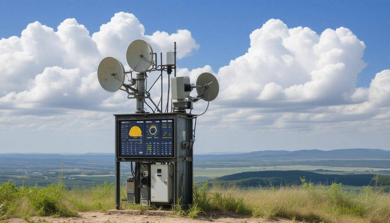
The realm of technological indicators includes sophisticated tools such as satellites, radars, and automated weather stations that provide precise information about weather patterns. For instance, Doppler radar has transformed how meteorologists predict severe weather events by detecting movements within storms. This technology measures precipitation and assesses how rain or wind is shifting in real-time.
According to the National Weather Service, this advancement has improved forecast accuracy for severe weather by up to 80%. That staggering statistic highlights how crucial these tools are in helping us prepare for potential danger.
When combined with traditional observational skills, technological indicators create a more comprehensive view of what might happen next. Imagine you’re at a picnic and see dark clouds starting to roll in. While you might instinctively want to grab your things based on the natural signs alone, having access to a weather app on your smartphone could provide insights about when exactly the storm will hit or whether it’s worth staying put just a little longer.
Moving from this blend of natural and technological signs, let’s now turn our attention to time-tested cues that many people still rely on today.
Traditional Clues and Natural Signs
Long before we had smartphones with weather apps, people relied on their observations of nature for guidance. For instance, temperature changes are often one of the most straightforward signs. A sudden drop in temperature can signal an approaching cold front while warmer, humid air typically precedes rain. Many seasoned outdoors enthusiasts will tell you that when the breeze suddenly shifts, it’s essential to pay attention; this shift often precedes a storm.
Observing Cloud Patterns
When it comes to cloud formations, they are not just beautiful fluff in the sky—they’re incredibly telling about future weather. Cirrus clouds, characterized by their high-altitude wispy appearance, suggest good weather yet hint at changing conditions ahead. This might seem counterintuitive since they look so peaceful; however, when cirrus clouds appear, it’s a sign that moisture is increasing aloft. On the other hand, cumulonimbus clouds, which tower upwards and are dark at the base, are notorious harbingers of thunderstorms and heavy rainfall.
Interestingly, fishermen have tuned into these signs for centuries: they know that if whales breach more frequently near shore, big storms may roll in soon. Understanding such clues fosters connection with nature while providing valuable insights that remain relevant even in our tech-savvy world.
But don’t overlook animal behavior—those furry or feathered friends of ours offer their unique indicators as well.
Animal behavior also plays a crucial role in weather forecasting among traditional methods. Have you ever noticed how birds seem to behave differently before a storm? When birds fly low or disappear from sight entirely, it’s often an indication that turbulent weather is on the way as they sense changes in atmospheric pressure. Additionally, livestock can provide helpful signals; cows lying down indicates a drop in barometric pressure, which commonly brings rain!
Listening to Nature’s Voice
Another element that’s less overt but equally revealing is the sounds of nature around you. Many experienced campers will attest that if you hear insects like crickets chirping faster than usual, it may indicate rising temperatures—which could suggest that a warm front is heading your way. Similarly, predicting rain can be achieved by noting the distinctive scent of petrichor wafting through the air just before drops start falling.
The interaction between all these natural cues creates a tapestry of information that can lead to a better understanding of forthcoming conditions. Embracing this knowledge allows outdoor adventurers not only to prepare adequately but also to cultivate respect for the environment’s myriad signs.
Even though we’ve covered many traditional methods, exploring how advancements in technology enhances our understanding today could provide further valuable insights.
Technological Advances in Forecasting

Modern technology has fundamentally transformed weather forecasting from a practice rooted in observation into a precise and intricate science. This shift has been driven largely by significant advancements in satellite technology and high-performance computing. These innovations have allowed meteorologists to analyze vast amounts of data with remarkable accuracy.
For example, the European Centre for Medium-Range Weather Forecasts (ECMWF) has developed models capable of providing forecasts that can be valid for up to 15 days in advance, which is a game-changer for various industries and everyday life.
Satellites and Sensors
At the heart of these improvements is the role of weather satellites, which orbit Earth and gather real-time data on a global scale. These satellites systematically track phenomena such as cloud movements, sea surface temperatures, and wind patterns. A standout example is the GOES-16 satellite, which provides astonishingly high-resolution images of weather systems every 30 seconds. This level of detail enables meteorologists to monitor storms as they develop and predict their paths with unparalleled precision.
But it’s not just about capturing imagery; it’s about how this data translates into actionable insights. With state-of-the-art remote sensing technology, forecasters can analyze atmospheric moisture content, temperature fluctuations, and even monitor wildfire smoke dispersal or volcanic ash clouds. This real-time insight becomes critical during severe weather events like hurricanes or winter storms where timely warnings can save lives.
As vital as satellite data is, its true potential is unlocked through advanced computational techniques that process this information—and that’s where high-performance computing comes into play.
High-performance computing allows for the processing of colossal data sets collected from satellites, radar systems, and ground-based sensors at lightning speed. Traditional weather predictions were hampered by limitations in processing abilities; now we’re able to run complex simulations that create hundreds or thousands of different possible scenarios based on varying initial conditions. This method aids in identifying trends and possible outcomes which helps to refine models continuously using real-world observations.
The Role of Artificial Intelligence
As we embrace higher levels of complexity, artificial intelligence (AI) plays an increasingly crucial role by enabling faster pattern recognition and anomaly detection than ever before. By leveraging machine learning algorithms, forecasters can improve both the accuracy and efficiency of predictions. AI helps in detecting subtle changes that may indicate an impending weather event—information that would be nearly impossible for human analysts to digest quickly enough on their own.
In essence, what we’re witnessing is a blend of traditional meteorological knowledge augmented by tech-driven insights—creating a dynamic forecasting environment that adapts to evolving patterns.
With these technologies working together harmoniously, it opens up numerous possibilities for further improving how we understand and interpret atmospheric phenomena while also laying the groundwork for innovative strategies in gathering and processing data more efficiently.
Data Collection Techniques
Accurate weather prediction starts with precise data collection. There are various techniques used to gather meteorological data, each playing a significant role in creating reliable forecasts. One prominent approach is through ground-based methods. Ground-based techniques include weather stations, anemometers, and barometers. Weather stations are essential pieces of equipment located in diverse environments to record temperature, humidity, air pressure, and wind speed—fundamental elements for creating robust weather models. This localized data provides a detailed picture of current conditions, invaluable for making short-term forecasts.
Ground-Based Methods
As we consider ground-based methods, it’s clear how they contribute to understanding local weather conditions. For instance, anemometers measure wind speed and direction, providing critical insights into storm developments and predicting severe weather events. Barometers also play a role by tracking air pressure changes indicating incoming systems such as cold fronts or hurricanes.
Some experts argue that despite the surge of remote tools, ground-based methods remain indispensable for localized data. This is particularly true for urban areas where microclimates can significantly affect the weather. In these cases, localized measurements often outshine generalized data from satellites or electronic sources.
Remote Sensing
The advancement of technology has introduced remote sensing as a game-changer in meteorology. Remote sensing involves using satellites and radar systems to collect data from afar without direct contact with the environment. For example, NASA’s Moderate Resolution Imaging Spectroradiometer (MODIS) collects essential information about atmospheric conditions, land and sea temperatures, and cloud cover to support accurate weather forecasting.
By analyzing images captured from space, researchers can monitor large-scale patterns that influence local climates—from hurricane developments over ocean surfaces to changes in vegetation across land masses. Remote sensing allows meteorologists to access vast areas quickly and reliably, making it impossible with ground-based methods alone.
However, these two methods work best when combined; integrating both ground-based and remote sensing techniques creates a comprehensive understanding of the atmosphere. This collaboration enhances our ability to analyze upcoming atmospheric phenomena more effectively.
Analyzing Atmospheric Patterns
Atmospheric patterns are the unsung heroes in the grand scheme of weather prediction. To a casual observer, temperatures might shift daily, but behind those fluctuations lie complex interactions among various meteorological forces that shape our environment. Understanding these intricate dynamics helps us predict what lies ahead, from sunny picnics to stormy nights.
High and Low-Pressure Systems
At the heart of weather forecasting is the dance between high and low-pressure systems. High-pressure zones often indicate fair weather; they act as protective blankets, pushing away clouds and giving way to clear skies. However, this apparent tranquility can lead to oppressive heat—like being stuck in a car during a sweltering afternoon with no air conditioning.
Conversely, low-pressure systems are the harbingers of change. These systems trap moisture and invite clouds to gather, often leading to rain and storms. Imagine low pressure as a sponge soaking up water; when it gets too full, it releases its contents in the form of precipitation. Observing shifts from high to low pressure can inform seasoned forecasters when rain is approaching.
Remember: High pressures clear the sky but may lead to heatwaves while low pressures promise rain but also invigorate plant life needing water.
Jet Streams
Another critical element contributing to weather phenomena is the jet streams. Picture these as fast rivers of air located high in the troposphere that sculpt our weather like an artist shaping clay. They flow at impressive speeds—sometimes exceeding 200 mph—and their influence stretches far beyond their immediate surroundings. They steer weather systems across continents and dictate temperature variations over regions.
To visualize it further, think of jet streams as highways in the sky where weather systems travel and intermingle. The position and strength of these jet streams can determine whether we experience milder temperatures or face an arctic blast sweeping down from the north. When jet streams shift southward, cool air plunges into areas typically warm and temperate.
The temperature lapse rate—the tendency for temperature to decrease with altitude—plays into this dynamic as well. For every kilometer you ascend into the atmosphere, temperatures drop by about 6.5°C. Consequently, understanding how jet streams move can help not just with predicting temperature changes but also forecasting specific conditions like thunderstorms.
By thoroughly examining these atmospheric patterns, we equip ourselves with essential tools for anticipating what the sky has in store for us next and how it might affect our plans in varying ways in terms of precipitation or sunny days ahead.
Predicting Rain, Storms, and Sun
Understanding how to predict rain hinges on keeping an eye on three main factors: humidity levels, air pressure, and temperature. When humidity reaches about 70% or higher, it suggests that the air is saturated with moisture, increasing the likelihood of rain.
As a general rule of thumb, when there’s a significant drop in barometric pressure—more than 0.5 inches in a 24-hour period—you can expect precipitation on the horizon. Moreover, if you notice a sudden temperature dip (over 10°F) paired with rising humidity, you’re likely in for a shower.
Combine these elements and you have a solid basis for predicting rain. For instance, if you observe cumulonimbus clouds building up—those towering, dark clouds—it’s almost a sure sign that rain or thunderstorms are imminent. Thankfully, modern radar technology enhances our understanding by pinpointing where rain is occurring and its intensity, giving you valuable information to plan your day accordingly.
Predicting Storms
Storm prediction is inherently more intricate because of the numerous variables involved. Factors such as high humidity, differences in temperature across distances (known as temperature gradients), and wind shear—which is the change of wind speed and direction with altitude—all contribute to the formation of thunderstorms.
When these variables align just right, clouds begin to swirl ominously in the sky.
Doppler radar has revolutionized storm tracking by providing real-time data about storm systems’ movements and strengths. It allows us to see the wind patterns within storms and anticipate not just their development but also their trajectory. Satellite imagery complements this by offering a broader perspective of weather systems across regions, helping meteorologists foresee severe weather events.
Predicting Sunny Weather
On the contrary, predicting sunny conditions tends to be less complicated but still requires diligence. High-pressure systems are often the culprits behind clear skies, ensuring that air is descending rather than rising—keeping cloud formation at bay. However, even under high pressure, conditions can shift unexpectedly due to various atmospheric dynamics.
Continuous observation is essential; conditions can morph rapidly regardless of what looks promising at first glance. As we build upon these foundational insights, we will explore more advanced methods and tools that further enhance our ability to forecast weather accurately.
Using Technology for Accurate Forecasts
In the ever-evolving world of meteorology, technology plays a pivotal role in enhancing the precision of weather forecasts. With advanced computing power and sophisticated algorithms, meteorologists can analyze vast amounts of data with unprecedented speed. This is where weather modeling programs come into play. Programs like the Global Forecast System (GFS) and the ECMWF (European Center for Medium-Range Weather Forecasts) are utilized by weather professionals across the globe. They process trillions of data points within intricate grids to simulate atmospheric behavior accurately, predicting everything from temperature fluctuations to storm patterns.
The sheer scale of data these models handle illustrates how critical accurate observational data is in forecasting.
Weather Modeling Programs
The power of weather modeling programs lies not just in their ability to calculate but also in their reliance on comprehensive sources of information. They incorporate feedback from satellites, weather stations, and radar measurements. For instance, global models cover extensive geographical areas, while mesoscale models focus on localized weather phenomena. This layering of data creates a nuanced view of weather systems and enhances predictive accuracy.
Think of it this way: If you were trying to understand a large puzzle, using diverse perspectives—like zooming in on specific pieces—would reveal the bigger picture much more effectively.
Now turning to personal applications,
Mobile Applications
Mobile apps like Weather Underground and AccuWeather have emerged as essential tools for individuals looking to stay informed about local weather conditions. These applications utilize real-time data collected from various sources, delivering hyper-local forecasts that cater specifically to user preferences. Imagine you’re planning an outdoor event—these apps allow you to receive notifications about upcoming rain or temperature drops right where you are.
Furthermore, many of these applications integrate radar imagery and alerts for severe weather, which can be particularly useful in dangerous situations. The convenience they offer means that people can make real-time decisions based on accurate weather predictions instead of waiting for general news broadcasts.
While technology provides substantial benefits in weather forecasting,
It’s important to remember that augmenting tech with DIY weather prediction methods can enhance our understanding of atmospheric changes even further. By observing clouds, wind direction, and temperature variations firsthand, one can develop a more intuitive grasp of localized climate conditions—creating a synergistic relationship between technology and natural observation.
With this blending of insights, let’s explore how simple techniques can empower you to make your own predictions about the weather ahead.
DIY Weather Prediction Tips
You don’t need advanced tools to make basic weather predictions. In fact, using your senses and simple observations can lead to surprisingly accurate forecasts for upcoming weather changes. This personal approach not only makes the process enjoyable but also helps develop a strong intuition about atmospheric conditions.
Observe the Clouds
By learning to identify cloud types, you can make fairly accurate short-term weather predictions just by looking up at the sky. Observing cloud formations turns into a fascinating, almost meditative practice as you connect with nature.
For example, cirrus clouds, those thin and wispy streaks high in the sky, often indicate that changes are on the way—perhaps a warm front or rain within a couple of days. Meanwhile, cumulonimbus clouds, which are dense and towering, signal thunderstorms or severe weather in the near future. Lastly, stratus clouds, appearing as low-level blankets covering the sky, frequently bring continuous rain, so it’s wise to pack an umbrella when you see them creeping in.
Beyond cloud-watching lies another significant aspect of predicting the weather with ease.
Wind Direction and Speed
Monitoring wind direction and speed can provide vital clues about incoming weather conditions. Wind dynamics have historically guided sailors who relied on shifts to predict storms or changes in climate as they navigated through waters.
A sudden shift towards the southeast might indicate an approaching low-pressure system associated with stormy weather. On the other hand, if you notice a consistent breeze from the northwest, it often correlates with stable and clear skies ahead.
Combining these observations creates a more comprehensive understanding of weather patterns. Regularly taking note of how wind interacts with temperature and humidity around you enhances your forecasting skills remarkably.
One of the simplest yet effective tools that you can employ for DIY weather predictions is a barometer.
Using a Barometer
A barometer measures air pressure and serves as an essential companion for your forecasting toolkit. When observing its readings, pay close attention: falling pressure usually signals an approaching storm or inclement weather, while rising pressure tends to indicate fair conditions on the horizon.
It’s interesting to note how many people still overlook this classic tool amidst modern technology! In addition to understanding barometric trends, building a habit of checking local forecasts daily can also enhance your accuracy while engaging in outdoor activities like camping or hiking. By combining traditional observational methods with technology—such as apps that integrate atmospheric pressure readings—you’ll find yourself better equipped for any situation that comes your way.
Ultimately, embracing these DIY methods will empower you to make informed decisions whenever adventures beckon.
By honing your observation skills and utilizing simple tools, you’ll be well-prepared for whatever Mother Nature has in store. Understanding these key signs and indicators transforms weather prediction into a rewarding experience.