
Navigating through the wilderness can be as thrilling as it is daunting. What happens when you’ve taken a wrong turn or lost sight of the trail? That’s where emergency navigation tools become not just helpful accessories, but lifesavers. Compasses, signal mirrors, and multi-tools are essential items that can empower you to find your way back home—no matter how challenging your journey becomes. Having spent countless hours exploring different terrains and gathering insights on these tools, my aim is to share with you what I’ve learned about their crucial roles in any adventurer’s kit. Whether you’re a seasoned hiker or a weekend wanderer, understanding these tools can mean the difference between feeling lost and making your way safely to familiar ground.
The Emergency Navigation Tools: Complete Guide provides essential information on various tools such as compasses, signal mirrors, fire starters, and multi-tools, detailing their functionalities and best practices for use in critical situations. You will also discover statistics highlighting the importance of preparedness in outdoor adventures, insights into modern technology’s role alongside traditional methods, and practical tips to ensure you can navigate safely in emergencies.
Essential Emergency Navigation Tools
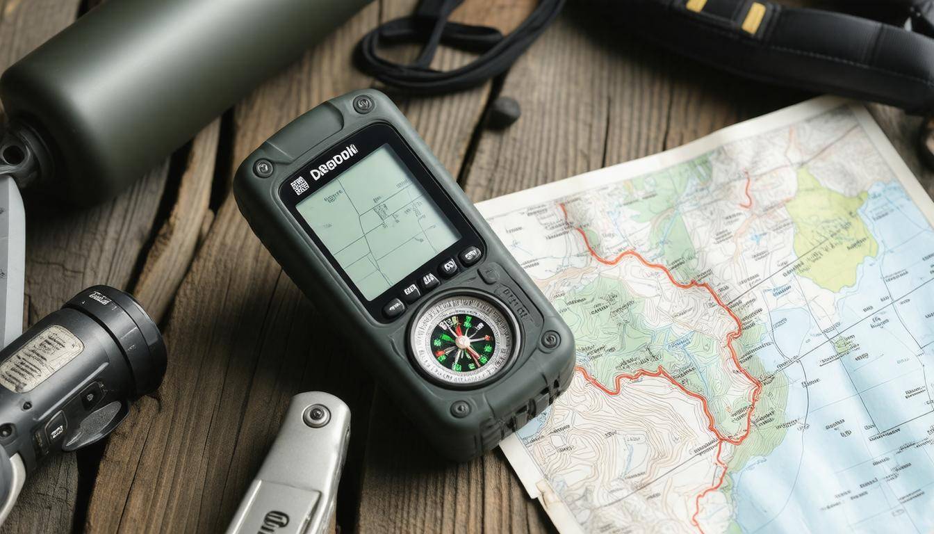
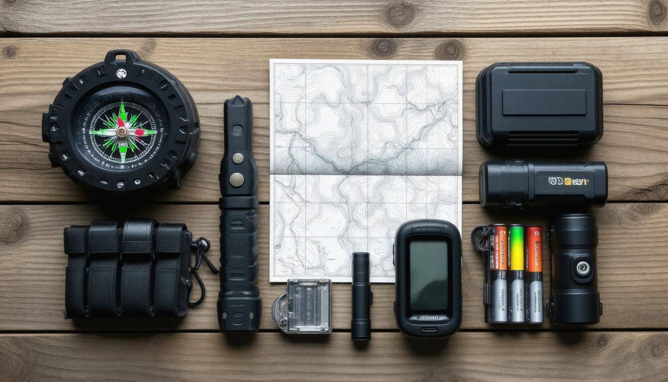
Compasses are an indispensable staple for anyone venturing outdoors. Take the Suunto A-30, for example; it has gained a reputation for its impeccable accuracy and tough design. With luminescent markings, it’s designed for nighttime navigation too, which can be a game-changer under the stars or in low-light conditions. Unlike GPS devices, compasses don’t rely on batteries or signals—they function effectively wherever you might wander on the globe. This reliability allows you to find cardinal directions and maintain your sense of orientation as you consult your map.
Beyond a compass, understanding how to signal for help is equally vital during emergencies.
Signal Mirrors
Moving on, let’s explore signal mirrors, often underrated but incredibly effective tools for communication in distress. These mirrors can reflect sunlight over tremendous distances and deliver a visual signal that will catch the attention of rescuers miles away. For example, consider the SOL Escape Lightweight Signal Mirror—not only is it highly durable, but it makes signaling straightforward even in adverse weather conditions.
I recall reading about a hunter caught in thick woods who was able to signal a helicopter using his mirror and ultimately receive life-saving assistance. With just a flick of light, these small devices prove that sometimes the simplest solutions make the most significant impact when every second counts.
Now along with reliable navigation tools like compasses and signal mirrors, carrying additional versatile gear enhances overall survival strategies.
Multi-Tools and Fire Starters
Multi-tools are another essential asset in any adventurer’s kit. For instance, tools like the Leatherman Wave+ offer multiple functionalities—from cutting rope to opening cans—eliminating the need to carry several separate items while remaining lightweight. The versatility ensures that you’re prepared for various situations without being weighed down.
And let’s not forget fire starters! Something like magnesium fire starters or waterproof matches can be critical; approximately 60% of emergency situations happen in conditions where starting a fire is paramount for warmth or cooking food. Imagine being stranded overnight with temperatures dropping fast; your ability to create warmth through fire could mean the difference between comfort and potential hypothermia.
While technological advancements such as smartphones offer convenience, they shouldn’t entirely replace traditional tools.
Modern vs. Traditional Tools
It’s noteworthy that while many outdoor enthusiasts have started integrating smartphone applications into their navigation arsenal, these modern tools should always be supplemented with classic ones like compasses and maps. Technology can fail—batteries die, and reception fades once you’re deep within dense forests or rugged terrains. Having tangible tools means you won’t be left scrambling when your phone runs out of battery or loses signal in challenging environments.
Your survival preparedness hinges on your understanding of essential navigation tools and their application under various circumstances—being equipped is not just smart; it is vital for your adventure’s success and safety.
Understanding both traditional and modern navigation tools equips you better for varied adventures ahead, allowing you to make informed choices about the direction you take next.
Top Digital Devices for Navigation
Digital devices have indeed transformed how we navigate through both familiar and uncharted terrains, allowing users greater ease and precision than ever before. For outdoor adventurers, GPS devices and smartphone applications have become the go-to tools that ensure one can find their way, no matter how dense the forest or vast the mountain ranges. However, reliance on battery power and signal availability can present challenges when you need them most.
GPS Devices
It’s fascinating to note that approximately 70% of outdoor enthusiasts now carry a GPS device during their adventures. Among these, the Garmin GPSMAP 66i is a premier choice revered for its robust satellite reception and impressive battery longevity. This model offers a staggering battery life of up to 35 hours, far surpassing that of typical smartphone GPS apps, which generally function between 12 to 24 hours depending on usage.
| Feature | Garmin GPSMAP 66i | Smartphone GPS Apps |
|---|---|---|
| Battery Life | Up to 35 hours | 12 to 24 hours |
| Signal Strength | High | Variable |
| Durability | High | Low |
Each feature makes it clear why many adventurers choose standalone GPS devices like the Garmin. Their durability is notably higher, constructed to withstand harsh environmental conditions such as rain or extreme temperatures—something that typically hobbles standard smartphones.
Smartphone Applications
But let’s not discount the capabilities of smartphone applications, as they too are invaluable in our navigational toolkit. Applications such as Gaia GPS and AllTrails allow users to download maps and routes in advance for offline use, ensuring that even when cell service drops off the grid, you’re not left lost. This aspect underscores an essential safety tip: always prepare your app with offline maps when heading out into remote areas.
Yet, despite this technological edge, it’s crucial to accompany these digital tools with physical navigation backups—like a traditional compass or printed maps—because technology can fail you at critical moments. Having a multifaceted approach ensures you can adapt when faced with unexpected situations.
With an understanding of digital navigation tools firmly established, we can now explore robust alternatives that provide reliable guidance without relying on batteries or signals.
Reliable Analog Navigation Options
Among the most basic but essential analog tools are maps, particularly topographic maps. These maps offer critical information about the terrain, showcasing its contours, elevations, and land features with striking detail. For anyone venturing into the great outdoors, being able to visualize the lay of the land is invaluable. It can mean the difference between stumbling through tough landscapes or confidently charting a safe course.
A journey across mountainous regions or dense forests becomes manageable with this foresight. The U.S. Geological Survey (USGS) provides free downloadable topo maps, making it easy to equip yourself before heading out. If you ever find yourself lost, these maps will not only help you pinpoint your location but also identify nearby water sources or potential escape routes from challenging terrains.
But understanding one’s position is only part of the equation; knowing how high up you are can give you further insight into your surroundings.
Altimeters
This is where altimeters come into play. An altimeter measures elevation, which helps you understand your position relative to the terrain around you. When used in conjunction with a topographic map, an altimeter can drastically enhance your navigational accuracy—especially in mountainous areas where elevation changes steeply.
Imagine hiking up a mountain: knowing exactly how high you are informs your journey and guides your planning for potential weather changes.
It’s important to know how to interpret both altimeter readings and map contours effectively. For example, if your altimeter reads 5,000 feet and your map indicates a peak at 6,000 feet just a mile away, you’ve got a clear goal ahead of you. Moreover, keep in mind that atmospheric pressure affects altimeter readings, so be sure to calibrate frequently against known elevations.
Furthermore, there are many instances where relying solely on one tool isn’t sufficient for effective navigation.
Bringing multiple analog tools ensures you’re covered from multiple angles. Alongside maps and altimeters, consider incorporating a reliable compass into your toolkit as well. A compass provides fundamental directional information—a necessity when visibility is low or when digital options fail. Brands like Suunto have long been favored by outdoor enthusiasts for their durability and accuracy.
Remember, combining these analog tools enriches your overall navigational capacity! When technology fades away and you’re left with just these classic instruments, they ensure that every journey has a path home.
Shifting gears, let’s explore the various strengths and weaknesses of different navigation tools that adventurers might consider when preparing for their next expedition.
Pros and Cons of Various Tools
Every navigation tool has its strengths and weaknesses, which means that understanding them helps you make better choices in survival situations. Let’s explore digital tools, analog methods, and how they stack up against one another.
Digital Tools: High Tech, High Stakes
Digital navigation tools, such as GPS devices and smartphone apps, offer exceptional accuracy and user-friendly interfaces. With the ability to store multiple maps and provide real-time updates about weather conditions, these high-tech options can significantly enhance your outdoor experience.
For example, imagine hiking through a dark forest during an unexpected storm; having access to live weather alerts could mean the difference between safety and a perilous situation. Yet with their advanced capabilities come significant vulnerabilities. The dependency on batteries is a primary concern; should your device die or run out of power, you could quickly find yourself lost. Furthermore, digital tools can fail—software glitches or damage from impact can render them useless in critical moments. While they provide convenience and instant information, relying solely on technology may leave you stranded when facing nature’s unforgiving elements.
Technology is also not always reliable in less connected areas. Signals may drop in remote locations far from cell towers or be obstructed by mountains or thick forest coverage. This means that having an alternative like analog tools can really pay off.
Analog Tools: Reliability Over Complexity
In contrast, analog tools, like compasses and traditional maps, boast durability and simplicity that often outshine their digital counterparts in rugged environments. They don’t require batteries and are generally more resilient against environmental factors like rain or snow—this makes them an invaluable part of any survival kit.
For instance, using a compass might seem rudimentary compared to a GPS unit, but it’s reliable even in dense forests where electronic signals may falter. However, as appealing as their simplicity is, analog tools do come with their own set of challenges. Understanding how to read a compass or navigate via map requires specific skills that not everyone possesses. In unfamiliar terrains lacking visible landmarks, interpreting these tools effectively can become significantly more difficult.
As we analyze these attributes further, the combination of both types of tools—digital for detail and analog for reliability—creates a robust navigation strategy for outdoor adventurers. Statistics show that most experienced hikers opt to carry multiple navigation methods to ensure they never rely too heavily on any single device while navigating nature’s unpredictable embrace.
Survival Scenarios and Tool Usage
When you find yourself lost in the wilderness, every second counts. Imagine you’re hiking through dense woods, enjoying the serene beauty when you suddenly realize you’ve strayed off your planned route. In this kind of situation, having a compass by your side can be a game changer. You pull out your compass and hold it flat in your hand, then rotate until the needle aligns with north. This simple act helps you orient yourself correctly, guiding you toward safety.
But what if the terrain gets tricky? That’s where an altimeter comes into play. As you navigate, you notice the land dipping into a valley; using the altimeter helps you avoid descending into potential danger. It’s about harmonizing these tools to ensure not just survival but also the best path forward.
However, what happens when you’re facing a different kind of peril—like being stranded at sea?
Picture this: You’re adrift on a small boat, miles from shore. The sun blazes above, and your situation begins to feel increasingly daunting as the hours stretch on. It’s times like these that signal mirrors become invaluable. With just a flick of sunlight, you can attract the attention of passing ships or aircraft.
At the same time, to maintain your bearings towards land, deploying a compass is essential. By holding it steady and orienting it with your travel arrow, you keep yourself heading in the right direction.
These scenarios highlight that it’s not merely about having equipment; it’s about knowing how to use these tools effectively in varying environments. Each tool serves a purpose that ties back to ensuring your safety and navigating towards help or safety.
Experience is a key teacher here. Understanding how each navigational tool complements one another can significantly enhance your preparation for unexpected adventures, setting the stage for exploring various types of terrains and their unique navigation challenges.
Navigating Different Terrains
Each terrain you encounter presents its own set of challenges and requires specific strategies to navigate effectively. Whether you’re trekking through dense forests or crossing arid deserts, understanding how to use your navigation tools is critical for safety and orientation.
Dense Forests
In the thick embrace of dense forests, visibility can quickly diminish, making it easy to lose your sense of direction. Utilizing your GPS device allows for pinpoint accuracy—the bright screen reflecting small paths and clearings that might be invisible to the naked eye.
However, it’s vital to remember that technology isn’t infallible; sudden weather changes or dense foliage can disrupt satellite signals. Therefore, carrying a reliable map and compass alongside your GPS is not just recommended; it’s essential. You will have a backup at hand if your GPS fails, allowing you to maintain your route confidently using traditional navigation.
While forests demand precision in your navigational approach, deserts require a broader perspective and a keen awareness of natural landmarks.
Deserts
When braving the expansive landscapes of deserts, altimeters often become less effective due to the lack of significant elevation changes. Instead, let the striking landmarks guide you—distinctive dunes or rock formations offer not just visual markers but can also serve as crucial reference points on your map.
While compasses typically work well in open spaces, one must be cautious: certain areas may contain metallic deposits that throw off magnetic readings. The solution lies in honing your ability to observe the landscape; build an understanding of cardinal directions based on sun position during different parts of the day, which is an invaluable skill when navigating such vast areas where traditional navigation elements may falter.
Understanding these nuances is key—learning to adapt your skills and tools will enhance both your enjoyment and safety during outdoor expeditions regardless of terrain types.
Mountainous Regions
Moving into mountainous regions adds another layer of complexity due to varying altitudes and rapid weather shifts. By incorporating an altimeter along with your compass, you can gain insights into elevation changes that affect not only your navigation but also safety decisions regarding weather exposure.
Planning routes might involve using contour lines from a detailed topographic map which illustrates changes in elevation systematically.
The combination of these tools creates a comprehensive toolkit that enhances safety and ensures informed decision-making throughout your journey.
Now that we’ve explored navigation strategies across different terrains, let’s consider how urban environments also require their unique approaches when it comes to emergency navigation tools.
Building an All-Inclusive Navigation Kit
An all-inclusive navigation kit combines both digital and analog tools to create multiple layers of backup in survival situations, greatly enhancing your chances of making it back safely. Imagine setting out on an exciting hike, your heart pounding with anticipation, only to find yourself lost amidst the dense trees or rocky terrains. This is where the importance of having a well-thought-out navigation kit comes into play. Essential components should be carefully selected based on functionality, reliability, and ease of use.
Basic Components
-
Compass: A reliable compass is key for basic navigation. It helps determine direction when other tools fail, guiding you back on track.
-
Topographic Maps: Familiarize yourself with topographic maps that detail elevation changes and landscapes. They are invaluable when navigating unfamiliar terrains.
-
GPS Device: A handheld GPS device or a charged smartphone with offline maps can provide precise location tracking, allowing you to set waypoints for easy navigation.
-
Signal Mirror: This tool allows you to signal for help over long distances by reflecting sunlight, making it indispensable if you’re in distress.
-
Altimeter: Knowing your elevation can provide context on your surroundings and help orient yourself based on the terrain.
-
Waterproof Case: Protecting your essential tools from rain or splashes ensures they remain functional when you need them most.
These components enrich a navigation kit, combining traditional skills with modern technology. With this combination, you’re better equipped to face unexpected challenges while hiking or adventuring outdoors.
As engaging as that minimalist hiker who successfully navigated the Appalachian Trail through unpredictable weather using this exact combination illustrates, preparedness pays off.
However, assembling your navigation kit isn’t just about gathering these items; understanding how to use each one effectively is equally important.
This means taking the time to practice with your compass – learning how to read maps in various conditions and familiarizing yourself with your GPS device’s settings before heading out. Regular interactions with these tools will build muscle memory and understanding so that when you’re truly in need, everything comes naturally like second nature.
Practicing regularly not only reinforces your knowledge but also interlinks preparation with the excitement of exploration. Developing both skills and awareness paves the way for a more enjoyable outdoor experience while ensuring safety and responsibility.
Enhancing Skills with Training Programs
Tools are only as good as the person using them; this age-old adage rings especially true for emergency navigation skills. Without understanding how to effectively use your gear, even the best tools can fall short in critical moments. That’s why engaging in structured training programs is not merely beneficial—it is essential for anyone serious about their safety and effectiveness in uncertain environments.
Certification Courses
One foundational step you can take is enrolling in certification courses like those offered by the National Outdoor Leadership School (NOLS). These courses immerse you in hands-on training that challenges you to think critically and act swiftly during emergencies. Through simulated scenarios, you learn how each tool operates while gaining firsthand experience on making quick, informed decisions when facing real threats.
Think of it as building muscle memory—not just for your body but for your brain as well, ensuring that when panic sets in, your training kicks in seamlessly.
In fact, students often report a surge of confidence after completing these courses, realizing they have the skills to navigate through even the most daunting terrains rather than simply relying on GPS technology.
Practice Drills
Beyond taking formal courses, practice must also become an integral part of your learning process. Regular drills help solidify core skills and enhance your comfort with various navigation tools. Joining local orienteering clubs can turn what might initially feel like daunting practice into an enjoyable social activity. You get to engage with others who share your interests, tackle challenging courses together, and sustain motivation through friendly competition.
The journey of skill development doesn’t end with theory; incorporating these exercises into your routine maintains a sharp edge on your adaptation capabilities over time. Each session out there challenges your problem-solving skills and builds resilience in navigating unpredictable situations.
Thus, investing time in both structured training and practical application fortifies not only your proficiency with navigational tools but also enhances your overall readiness for any unforeseen hurdles life throws at you.
In mastering emergency navigation tools and techniques, you empower yourself to face uncertainties with confidence and composure. Prioritizing training ensures that you’re equipped not only to survive but also thrive when it counts the most.