
In a country as beautiful as Uganda, where mountains meet lakes and rich green valleys stretch for miles, the threat of natural disasters like landslides and floods often lurks just beneath the surface. For many communities, these risks are not just stories; they are realities that impact lives, homes, and futures. With around 30% of the population residing in regions vulnerable to such hazards, it is crucial to have plans in place that not only prepare but also empower these communities. The Uganda Landslide & Flood Preparedness Plan is one such initiative—it blends local knowledge with innovative strategies, showing how people can work together to safeguard their lives and property against nature’s unpredictable moods. By exploring this plan, we not only learn about safety guidelines but also discover stories of resilience and hope in the face of adversity.
The Uganda Landslide & Flood Preparedness Plan outlines proactive measures to mitigate risks associated with landslides and flooding, including community awareness programs, the establishment of early warning systems, infrastructure improvements, and coordinated response efforts among government agencies. It emphasizes the importance of local engagement and education to enhance community resilience against natural disasters.
Overview of Uganda’s Landslide & Flood Preparedness Plan
Uganda’s geographical landscape presents both beauty and vulnerability. With its mountainous terrains and heavy rainfall, the country faces a higher risk of landslides and floods than many other regions. The Landslide & Flood Preparedness Plan is designed to counteract these threats effectively—it’s not merely a policy but a lifeline for communities living in hazardous areas. Around 30% of Uganda’s population resides in zones susceptible to these disasters, highlighting the urgent need for preventative measures.
Key Objectives
At the heart of this preparedness plan lie several key objectives that form a comprehensive strategy:
-
Risk Identification and Assessment: Accurately mapping out vulnerable regions is essential. By utilizing advanced satellite imagery combined with ground reports, authorities can pinpoint areas most at risk. This valuable data serves as a foundational layer for all subsequent strategies aimed at mitigating losses.
-
Community Engagement: Collaboration with local communities emphasizes partnerships with non-governmental organizations (NGOs). Educational campaigns inform residents about potential risks and effective evacuation plans. Imagine rural families equipped with knowledge about safe routes they can take during emergencies—this proactive approach ensures that citizens respond effectively when disaster strikes.
-
Infrastructure Development: Building resilient structures is essential for long-term safety. Establishing fortified retaining walls or protective barriers in at-risk areas shields communities from the immediate threat of flooding or landslides while promoting sustainable urban planning practices that consider future climatic changes.
-
Early Warning Systems: Effective response relies on timely information. Implementing state-of-the-art monitoring technology aims to provide real-time alerts concerning weather patterns leading to potential disasters. Just imagine receiving an alert on your mobile device warning you of impending severe weather—this rapid communication can drastically reduce casualties and property damage.
-
Emergency Response Protocols: Setting up well-coordinated emergency response units forms an integral part of the plan. These units are designed for swift action, ensuring that help arrives promptly when it’s needed most. Following clear protocols allows them to navigate chaotic situations efficiently, making all the difference between life and death.
Given these objectives, it becomes essential to examine specific strategies employed within this framework that enhance resilience and effectiveness against disaster risks.
Key Strategies for Disaster Risk Reduction
At the heart of effective disaster risk reduction in Uganda lies a robust engagement with local communities. It’s essential to incorporate the knowledge and experiences of residents who witness the landscape’s changes firsthand.
Regular community meetings can be organized where individuals share their observations about weather patterns, water flow, and land erosion. This collaboration fosters an environment of collective learning, where everyone contributes valuable insights into the potential hazards their area may face.
For instance, engaging community members in training sessions on basic disaster preparedness can empower them to act swiftly during emergencies. People often underestimate how much they already know about managing local risks, and bringing that knowledge to light can be immensely beneficial.
Just imagine a group of farmers sharing stories about previous floods and discussing strategies that worked—or didn’t work—in securing their crops against impending threats. This kind of dialogue not only sustains tradition but also enhances community resilience by incorporating culturally relevant solutions.
Another pivotal strategy is developing and disseminating hazard information profiles. By creating tailored Hazard Information Profiles (HIPs) for different regions, stakeholders can better understand the specific vulnerabilities that exist within each community. These profiles allow for more effective planning since they break down data regarding past disasters, community demographics, environmental conditions, and existing resources.
Such detailed information is key when forming actionable plans that address both immediate needs and long-term resilience building.
Building upon these local assessments transforms the challenges into opportunities for proactive responses.
In addition, establishing partnerships with organizations such as UNDRR can enhance disaster response initiatives significantly. These partnerships not only provide access to global frameworks but also facilitate funding and training opportunities.
For instance, workshops led by experts can train local leaders in risk assessment techniques and emergency management practices. As communities become better equipped with knowledge, they can engage in informed dialogue with national policymakers to advocate for necessary changes in regulations or resource allocation.
It’s also crucial to leverage technology effectively while ensuring it’s accessible to all members of the community. For example, integrating GIS mapping tools helps visualize areas at risk of landslides or floods. With this information shared widely through public forums or community centers, residents can make informed decisions about daily routes or construction projects based on updated risk assessments.
Imagine a neighborhood rallying together after receiving a warning about potential flooding zones, enabling proactive measures like sandbagging efforts or relocating vulnerable assets quickly.
As part of ongoing education efforts focused on disaster awareness and risk reduction, it’s essential to engage young people directly through schools and youth programs. Children educated on safety protocols around flooding or landslides grow into adults who prioritize these issues within their families and communities, creating a strong foundation for future generations.
This comprehensive approach promotes a culture of resilience among Ugandan communities—one that emphasizes proactivity over reaction and nurtures an ongoing commitment to safety as climate change continues to escalate natural threats.
The integration of local knowledge and modern techniques forms a strong backbone for assessing risks effectively. Examining these processes further leads us to consider the critical role that community involvement plays in shaping risk assessment strategies.
Community-Based Risk Assessment
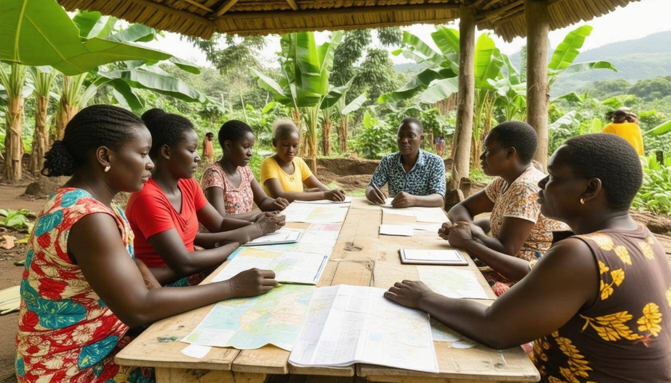
Conducting a community-based risk assessment allows residents to take an active role in identifying hazards, evaluating vulnerabilities, and fostering resilience. When the local population is equipped with the right tools and knowledge, they become empowered to confront natural disasters head-on. This process isn’t merely about collecting data; it’s fundamentally about creating a culture of preparedness that can save lives.
Methods of Engagement
One of the primary ways communities engage in this assessment is through workshops and training sessions. These gatherings focus on educating residents about early signs of potential disasters such as landslides and floods. By learning to recognize these indicators, locals can react quickly, mobilizing others or notifying authorities before conditions accelerate into emergencies. For instance, in eastern Uganda, trainings often cover different types of terrain and weather patterns to help participants understand what might trigger a disaster in their specific area.
Complementing these workshops is the practice of community mapping.
Involving residents in mapping out high-risk regions uses local knowledge paired with historical data for accuracy. This hands-on approach not only raises awareness but also gives community members a sense of ownership over their safety. By charting out flood zones or unstable slopes, families can establish emergency routes and identify safe havens that can be critical during evacuation. The insights gained from mapping efforts can directly inform local planning and government interventions.
This engagement fosters pride within communities while providing critical information for effective disaster preparedness strategies.
To fully prepare for emergencies, simulation drills must also play a pivotal role in community readiness.
Running simulation drills, like annual mock evacuations, ensures that residents practice their responses under simulated emergency conditions. These exercises allow communities to refine emergency protocols based on real-time experiences. Feedback gathered helps highlight areas needing improvement and enables community members to learn how to act efficiently without panic when an actual disaster strikes.
As Mr. John Okello rightly puts it, “The regular drills and mapping exercises have significantly increased our preparedness.” His words resonate widely — indeed places better prepared suffer fewer casualties during emergencies.
Through engaging local residents in these crucial methods, Uganda is building a more resilient future capable of weathering the storms brought on by landslides and floods. Each step taken today protects against potential tragedies tomorrow and reinforces the idea that preparation is not just a responsibility but an essential part of community cohesion.
These foundational efforts illustrate how proactive engagement can enhance safety measures in vulnerable areas, paving the way for further advancements in structural integrity and infrastructure enhancement.
Structural Adaptations and Infrastructure Improvements
In Uganda, the ongoing challenge of landslides and floods has prompted innovative approaches to structural adaptations and infrastructure improvements. One notable strategy involves the introduction of elevated housing designs specifically tailored for flood-prone areas. These homes, often built on stilts, serve a vital function by elevating living spaces above potential floodwaters, drastically reducing the risk of water damage. This clever adaptation protects residents and minimizes repair costs associated with flooding.
Furthermore, in landslide-prone regions, utilizing specific construction materials plays a crucial role. Lightweight yet structurally sound materials help mitigate the risk of collapse during adverse weather conditions. By opting for such materials, builders can ensure resilience against heavy rains or sudden ground shifts.
In addition to residential safety, road and bridge reinforcements form the backbone of effective disaster preparedness. Roads equipped with proper drainage systems act as lifelines during heavy rainfall, channeling excess water away from vulnerable areas while preventing erosion and waterlogging. It’s a proactive approach that allows communities to maintain access even in challenging conditions.
Similarly, reinforcing bridges to withstand high water flow is imperative for ensuring continuity in transportation and emergency services during flooding events. As rainfall patterns change due to climate fluctuations, the ability of these structures to endure increased water levels becomes paramount. Failing to invest in such reinforcements can lead to catastrophic failures—isolating communities when they need access most urgently.
Integration with Green Infrastructure
The strategy doesn’t stop at traditional engineering; it extends into combining hard structures with green infrastructure solutions. Implementing features like rain gardens and permeable pavements can significantly alleviate urban flooding risks, slashing potential flood damage by up to 30%. These environmentally friendly designs enhance the landscape while efficiently managing stormwater—benefiting both residents and nature.
“The integration of green solutions creates not just resilience but beauty within urban landscapes,” says an environmental engineer familiar with sustainable practices in urban design.
With these foundational improvements established, the next focus turns towards creating systems that provide timely alerts, further bolstering community preparedness ahead of potential disasters.
Enhancing Early Warning Systems
Uganda’s varied geography, which includes mountains, valleys, and rivers, makes it particularly susceptible to flooding and landslides. Therefore, an efficient early warning system can be a lifeline for communities at risk. The first step is implementing integrated weather stations. These stations should be strategically placed throughout the country, especially in areas known to be vulnerable. They will continuously monitor crucial environmental factors such as rainfall amounts, humidity levels, and soil saturation.
Integrated Weather Stations
By deploying these weather stations at critical locations—like mountaintops and flood-prone valleys—we can gather vital real-time data that helps us make informed decisions. This data feeds into a central command system designed to analyze trends quickly. For instance, imagine a heavy rainfall detected by these stations; they could immediately alert decision-makers about the potential for flooding in certain regions. This allows prompt advisories to be sent out to communities before dangerous conditions arise.
The effectiveness of these stations relies on their ability to transmit data instantly. Timely alerts can be the difference between life and death during sudden weather changes.
Mobile Alert Systems
In addition to weather stations, building an effective mobile alert system is essential. Sending out SMS alerts to residents ensures that everyone receives timely notifications about incoming threats. However, we shouldn’t stop there. Using local radio stations amplifies our reach dramatically since many rural communities rely heavily on radio broadcasts for information. By hosting regular discussions on disaster readiness during these broadcasts, we can enhance community awareness about risks and safety measures.
Fostering this dual-channel alert system facilitates immediate communication with populations that might not have access to digital platforms or who may lack literacy skills. For example, during heavy rains; if alerts go out via text messages and are also broadcast over local radio, even those without mobile phones stay informed.
Integrating advanced technology with community engagement significantly strengthens our emergency preparedness efforts while ensuring that no one is left behind in the process. Looking ahead, we can explore how essential training and resources further empower local communities to tackle these challenges effectively.
Training and Resources for Local Communities
Equipping local communities in Uganda with essential skills and resources forms the backbone of any disaster preparedness strategy. The National Emergency Coordination and Operations Centre (NECOC) has made significant strides in this area, focusing on practical workshops covering a variety of crucial topics. These programs aim to teach basic first aid and search and rescue operations while empowering individuals to create personal emergency response plans tailored to their unique situations.
Training Programs
Engaging local schools in disaster preparedness drills has a dual advantage: it equips children with life-saving knowledge while fostering a culture of safety within the community. Imagine schoolyards bustling with students practicing evacuation procedures and understanding how to assess emergencies—it’s an effective way to instill lifelong skills at an early age. Additionally, workshops focused on teaching community leaders can amplify the reach of crucial information, helping them become informed advocates for safety protocols in their neighborhoods.
Beyond just communication, these trainings emphasize collaboration and teamwork, encouraging residents to feel connected and responsible for one another’s safety.
Resource Distribution
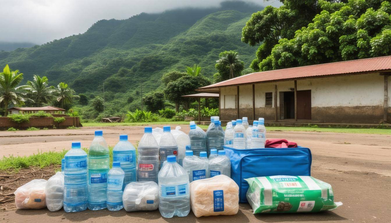
The distribution of emergency kits stands as a tangible representation of readiness. Imagine families equipped with essential items like flashlights, first aid supplies, and non-perishable foods; each kit serves not just as a precaution but as reassurance that help is readily available. The Uganda Red Cross Society has played a pivotal role in distributing over 10,000 such kits across high-risk areas, ensuring vulnerable households remain adequately prepared.
Furthermore, establishing community storage centers for essential disaster relief materials significantly strengthens local resilience. These centers provide immediate access during emergencies and act as hubs for ongoing training sessions where community members learn about resource management and distribution practices. These efforts ensure everyone knows where to find help when they need it most.
With the foundations laid through training programs and resource distribution, the focus now shifts toward enhancing measures that safeguard at-risk regions and their inhabitants.
Protecting Vulnerable Areas and Residents
Strategies aimed at safeguarding communities in high-risk zones must be proactive and adaptable to the continually changing environmental landscape. One of the most effective methods is through the implementation of zoning laws that restrict construction in areas more susceptible to disasters like landslides and flooding. This means any new developments will need to undergo rigorous risk assessments before approval, ensuring homes and infrastructures are built on stable ground.
Simultaneously, one shouldn’t underestimate nature’s power; promoting reforestation initiatives in deforested areas plays a pivotal role in stabilizing soil, reclaiming natural barriers against erosion, and enhancing water retention.
Alongside these measures, investing in relocation programs can significantly impact community resilience.
Developing government-backed initiatives to assist residents in relocating from high-risk zones addresses both immediate safety concerns and long-term sustainability. Such programs focus on the logistical aspects of moving while providing incentives that ease the financial burden of relocation. Whether it’s offering subsidies for housing or facilitating transportation, these tailored solutions create a pathway to safety while maintaining community ties. Moreover, public education becomes essential here; residents must understand the rationale behind these relocations to foster greater acceptance.
Collaboration with Organizations
Protecting vulnerable areas also necessitates robust collaboration between government bodies and international organizations dedicated to disaster risk reduction. The Uganda Red Cross Society, for instance, has been instrumental in mobilizing resources and providing immediate relief post-disaster while advocating for systemic changes. Their partnership with global entities such as the World Health Organization (WHO) ensures a well-rounded approach focusing on health services and hygiene education within these vulnerable communities.
It’s crucial to remember that sustainable solutions look beyond immediate effects. Comprehensive safety guidelines should encompass infrastructure improvements, early warning systems, and community training programs on emergency response.
Collaboration also extends into research opportunities; engaging local universities and institutions can yield valuable insights into climate patterns affecting these regions while adapting intervention strategies accordingly. When everyone works together—government agencies, local communities, and international organizations—we can build structures that are resilient against Mother Nature’s tumultuous moods while nurturing our surroundings rather than merely surviving them.
As we examine these collaborative efforts, it becomes evident how crucial partnerships are in fostering a unified approach toward addressing disaster risks and improving community resilience against environmental threats.
Government and International Collaboration

An effective response to natural disasters hinges on robust collaboration among various stakeholders, and Uganda’s government exemplifies this through its partnerships with international organizations. Each entity plays a vital role in providing immediate support while fostering long-term resilience against disasters like landslides and floods. The Ugandan government continuously works alongside these organizations to develop comprehensive disaster management strategies that account for both short-term relief and long-term community resilience.
Role of International Organizations
As the cornerstone of this collaborative effort, entities like the United Nations Development Programme (UNDP) offer invaluable technical expertise and funding essential for infrastructure improvements. Moreover, the World Bank serves as a critical financial partner by providing funds and loans aimed at large-scale disaster mitigation projects. These contributions symbolize a commitment from the global community to ensure Uganda is prepared for future crises.
| Entity | Contributions |
|---|---|
| UNDP | Technical expertise, funding |
| World Bank | Financial aid, loans |
| Red Cross | Emergency relief, training programs |
| Local NGOs | Community engagement, resource allocation |
Organizations like the Red Cross play a crucial role by offering emergency relief and training programs that equip communities to handle disasters effectively. Local NGOs amplify these efforts by engaging directly with communities, ensuring resources are allocated where they are most needed. This grassroots involvement builds a culture of preparedness within vulnerable populations.
An exemplary case highlighting the impact of such collaboration is the joint initiative led by the Ugandan government and the Red Cross, which successfully relocated over 3,000 families from high-risk areas in Bududa District. This proactive measure mitigated potential casualties during times of crisis while reinforcing community structures against future risks.
Ultimately, these collaborative efforts create a multi-layered approach to disaster management—a strategy that integrates local knowledge with international best practices, structurally sound infrastructure, and dedicated resources. With increasing cooperation among national and international partners, Uganda is steadily fortifying its defenses against relentless threats posed by landslides and floods.
In navigating the complexities of disaster preparedness, the unity of purpose shared by governmental bodies and international organizations serves as a compelling model for resilience and safety throughout Uganda’s communities.